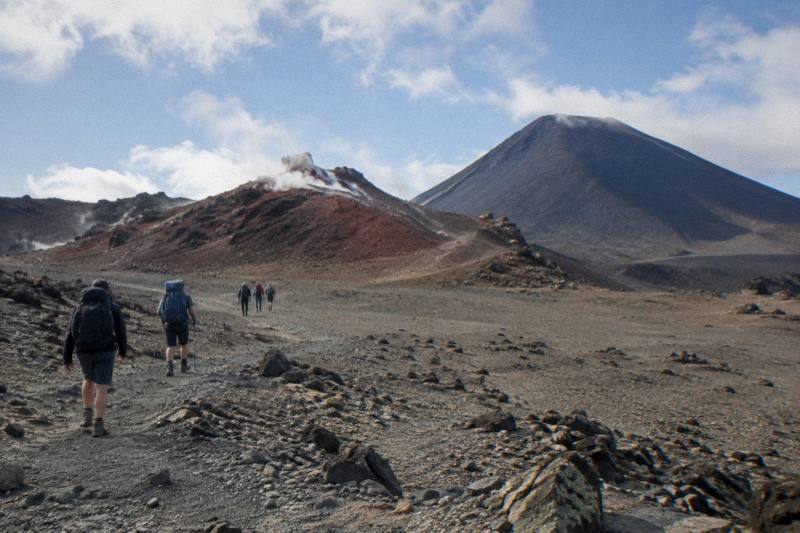
Tongariro Crossing Weather Above The Emerald Lakes: Wind, Cloud And Visibility
The Tongariro Alpine Crossing sits high enough that wind, cloud and visibility can flip several times between the Mangatepopo start and the Emerald Lakes. Here is how the weather works up there, where to check it, and how it should shape the day you book.
Short answer
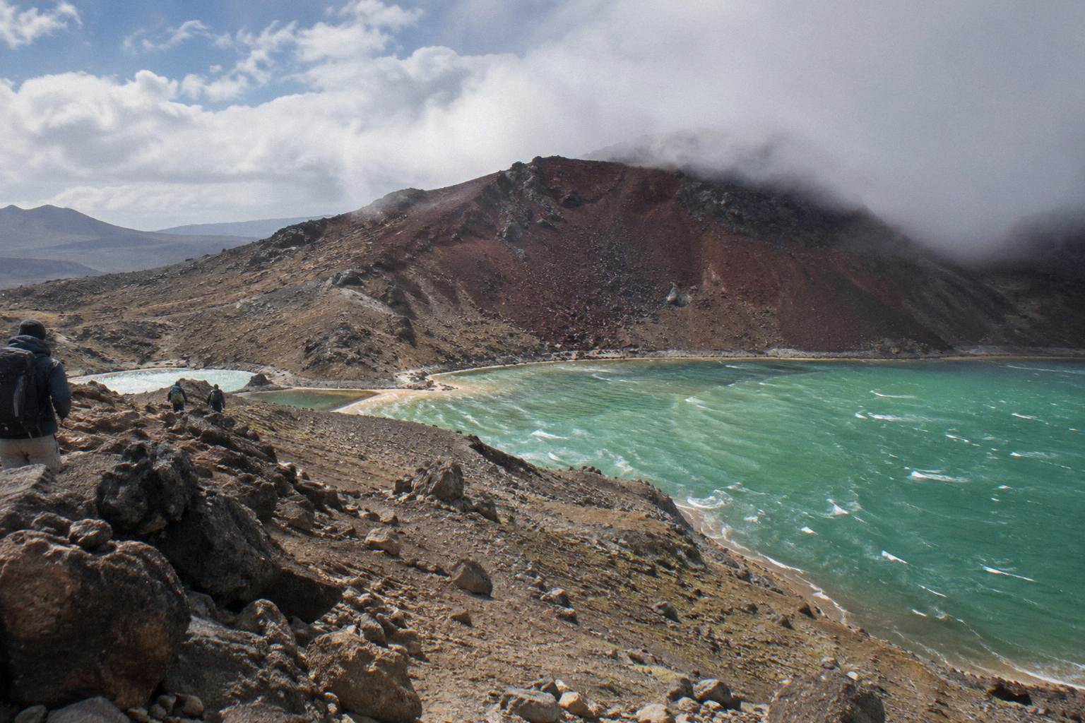
The Crossing climbs to 1886 m at Red Crater, 20.2 km one way with 1196 m of elevation change, and DOC rates the walk 7 to 8 hours from November to April and 9 hours from May to October. Conditions change fast at that height, so check the NIWA Tongariro National Park forecast and the DOC page before you go, and book a shuttle or guide rather than parking at the road end.
This page sits inside the wider Tongariro Emerald Lakes Hike guide collection, alongside pieces on how long the walk to the lakes takes and the distance and elevation to the Emerald Lakes.
| Quick Fact | Figure |
|---|---|
| Track length | 20.2 km one way |
| Elevation change | +/- 1196 m |
| Highest point | Red Crater, 1886 m |
| DOC time, November to April | 7 to 8 hours |
| DOC time, May to October | 9 hours |
| Fitness grading | High |
| Summer track class | Intermediate tramping track |
| Winter track class | Expert route |
Why The Weather Changes So Fast Above The Emerald Lakes
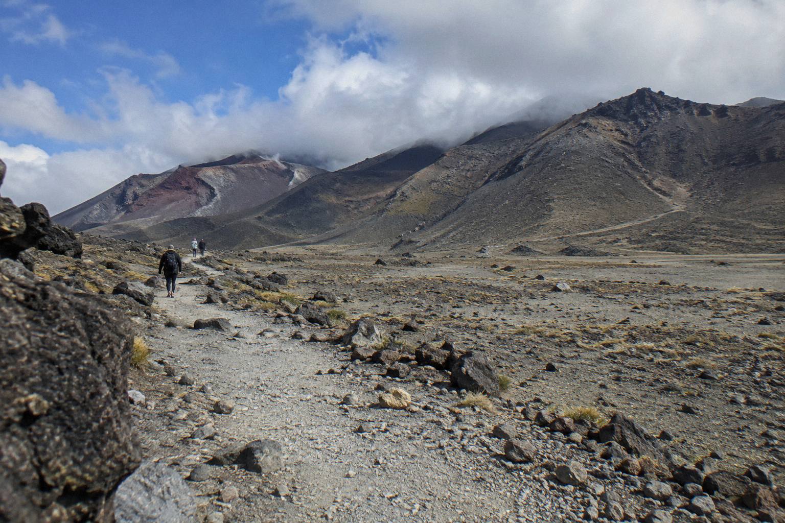
The weather above the Emerald Lakes changes so fast because the Crossing runs along an exposed alpine ridge between two volcanoes, and the air over that ridge behaves nothing like the still air at either car park. Walkers regularly leave Mangatepopo in mild conditions and meet strong wind on the South Crater flats within a couple of hours, and cloud can fill a valley or clear a ridge in minutes.
The track begins at Mangatepopo at 1120 m and finishes near Ketetahi Road at roughly 760 m, but the work in between is not a steady climb. You cross the South Crater basin, climb the ridge to Red Crater at 1886 m, then drop down a steep scree slope that DOC describes as the descent to the vivid Nga Rotopounamu, the Emerald Lakes. Each of those landforms funnels wind differently, and the craters themselves hold cold air and cloud longer than the ridgelines.
Mountain weather in the central North Island is driven by the interaction of moist air off the Tasman with the volcanic plateau. When a front is passing, the plateau can sit under clear sky while the Crossing ridge is in cloud, or the reverse. That is why a fine morning in National Park Village or Taupo tells you almost nothing about conditions at Red Crater, and why every piece of official advice points to a mountain-specific forecast rather than a town forecast.
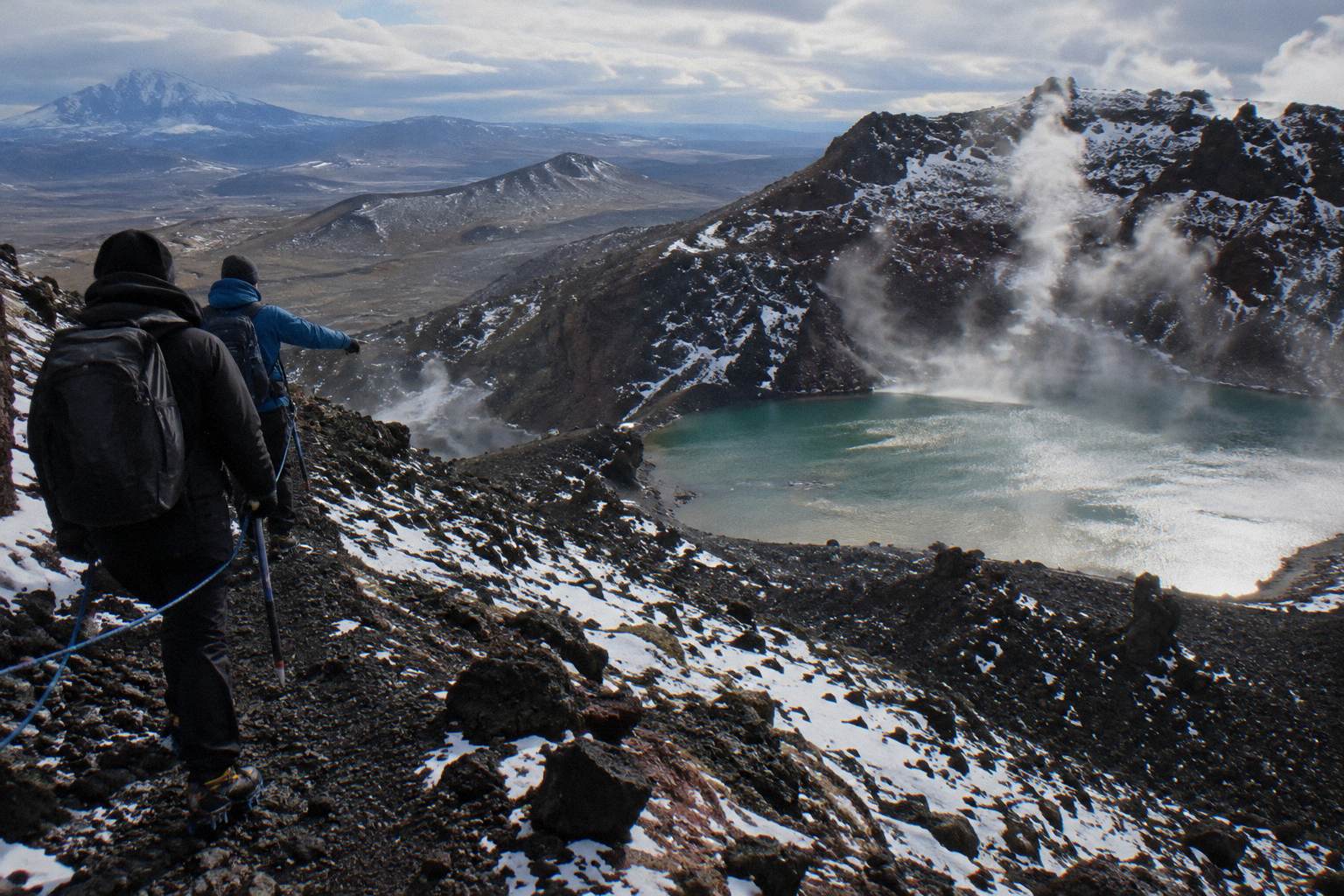
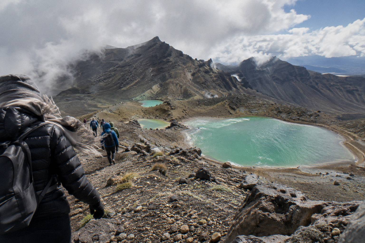
Visibility is the third variable, and for many walkers it matters more than rain. The Emerald Lakes and the Blue Lake are the visual payoff of the whole day, and the Red Crater view down to them exists only when the cloud base sits at or above the 1886 m rim. In cloud, the same terrain is navigable but bleak, and in winter cloud plus ice is the combination that turns the track into an alpine route. DOC's own summer and winter gradings reflect that shift.
This is also why the booking decision and the weather decision are the same decision. The three Adrift Tongariro guided tours include a guide who assesses conditions each morning, carries crampons and ice axes for winter conditions if required, and runs only when DOC's advisory allows. A shuttle, such as the Ruapehu Scenic Shuttles Ketetahi park-and-ride or the Tongariro Crossing Shuttles round-trip from National Park Village, gets you to the start in the right season, but the walking decisions on the track are yours.
Where To Check The Tongariro Forecast Before You Book
Use three sources, and check all of them the day before and again on the morning of the walk. The NIWA Tongariro National Park forecast is the specific mountain forecast for the park. The DOC Tongariro Alpine Crossing page carries the track alert status and the seasonal track class. GeoNet's Tongariro page shows the volcanic alert level, which changes daily. A town forecast for Taupo, Turangi or Ohakune is not a substitute for any of these.
NIWA's parks forecast for Tongariro National Park breaks the outlook down by elevation band, which matters because the walk runs from the Mangatepopo start at 1120 m all the way to the Red Crater rim at 1886 m. Read the band that matches the section you care about. The DOC page, meanwhile, is where the official word lives: the Tongariro Alpine Crossing track page carries the seasonal grading, the parking restrictions and any current alerts.
Volcanic hazard is part of weather planning here in a way it is not on most day walks. Tongariro is an active volcano, its alert level changes daily, and DOC publishes a volcanic risk page for the park that explains what the levels mean for track users: volcanic risk in Tongariro National Park. The 2012 Te Maari eruptions are a reminder that this is a live system, and the alert status belongs on the same pre-walk checklist as the wind forecast.
Booking itself goes through DOC's free system in the summer season. The DOC booking system for the Crossing is free, recommended, and needed if you are taking a shuttle or a guided day. It pairs with the parking rule: from Labour weekend in late October through 30 April, parking at the road ends is limited to 4 hours, and DOC suggests booking a shuttle.
| Source | What It Tells You | When To Check |
|---|---|---|
| NIWA Tongariro National Park forecast | Wind, cloud and precipitation by elevation band | Day before, morning of |
| DOC Tongariro Alpine Crossing page | Track alerts, seasonal grading, parking rules | At booking, day before |
| GeoNet Tongariro volcano page | Volcanic alert level, daily | Day before |
| DOC booking system | Free seasonal booking for walkers | When you book transport or a guide |
| Avalanche.net.nz | Winter avalanche danger | May to October only |
Once the forecast and the alert line up, the practical question is what kind of day to book. If the outlook is stable and you are confident on an intermediate tramping track, a shuttle does the job. If the outlook is marginal, or you are walking between May and October when DOC classes the track as an Expert route and says alpine skills are essential, a guided day is the safer structure, because conditions allowing is the operator's call, not yours alone.
How Wind Behaves On The Red Crater Ridge
On the climb to Red Crater the ridge is fully exposed to the prevailing flow, and the saddle between Red Crater and the Emerald Lakes descent can funnel wind hard enough to stop walkers in their tracks. Gusts strong enough to knock a person off balance are a routine reason guided days are reassessed each morning, making wind the biggest comfort and safety variable on the Crossing.
The structure of the mountain explains the pattern. The South Crater basin looks sheltered and often is, which lulls walkers into a false sense of conditions, but the moment you leave the basin toward Red Crater the ridge is fully exposed again. The final climb to the 1886 m rim is on loose volcanic scree, where a strong gust matters more than it would on firm ground. DOC's advice to treat the track as High fitness and to respect the seasonal grading is written with exactly these sections in mind.
On the descent from Red Crater to the Emerald Lakes, the exposure shifts. The scree slope drops steeply, and the lakes sit in a bowl that offers some shelter once you are down beside them, but the descent itself is committed: once you are on it, wind on the upper slope is something you manage, not something you retreat from easily. This is why experienced walkers check the wind forecast specifically for the mid-morning to early afternoon window, when the track is busiest and thermally driven wind often strengthens.
For most of the summer season a shuttle-based independent walk is entirely reasonable in moderate wind, and thousands of people do it. But if the forecast shows a front crossing on your only available day, the calculus changes. A guided day such as the Adrift Tongariro premium guided hike, from NZ$450 per person with free cancellation up to 14 days before, puts the go or no-go decision in the hands of a guide who runs the track regularly, and Adrift's guided days include transport from the base at 53 Carroll Street in National Park Village, plus crampons and ice axes for winter conditions if required. Bring your own lunch.
If wind is the worry but you still want an independent day, pick your departure point to shorten your exposure. The Ruapehu Scenic Shuttles Ketetahi park-and-ride, from NZ$68 per person with free cancellation up to 24 hours before, is a one-way park-and-ride: you park at the Ketetahi car park, ride to Mangatepopo, and walk the Crossing back to your own car.
Cloud, Visibility And Actually Seeing The Emerald Lakes
You only actually see the Emerald Lakes when the cloud base sits at or above the 1886 m Red Crater rim, since the rim and the upper scree descent are the only viewing points. Cloud filling the Central Crater or wrapping Red Crater won't make the summer track dangerous, but it erases the day's entire visual payoff; fortunately, cloud here often moves through, so waiting 20 minutes at the top can clear the view completely.
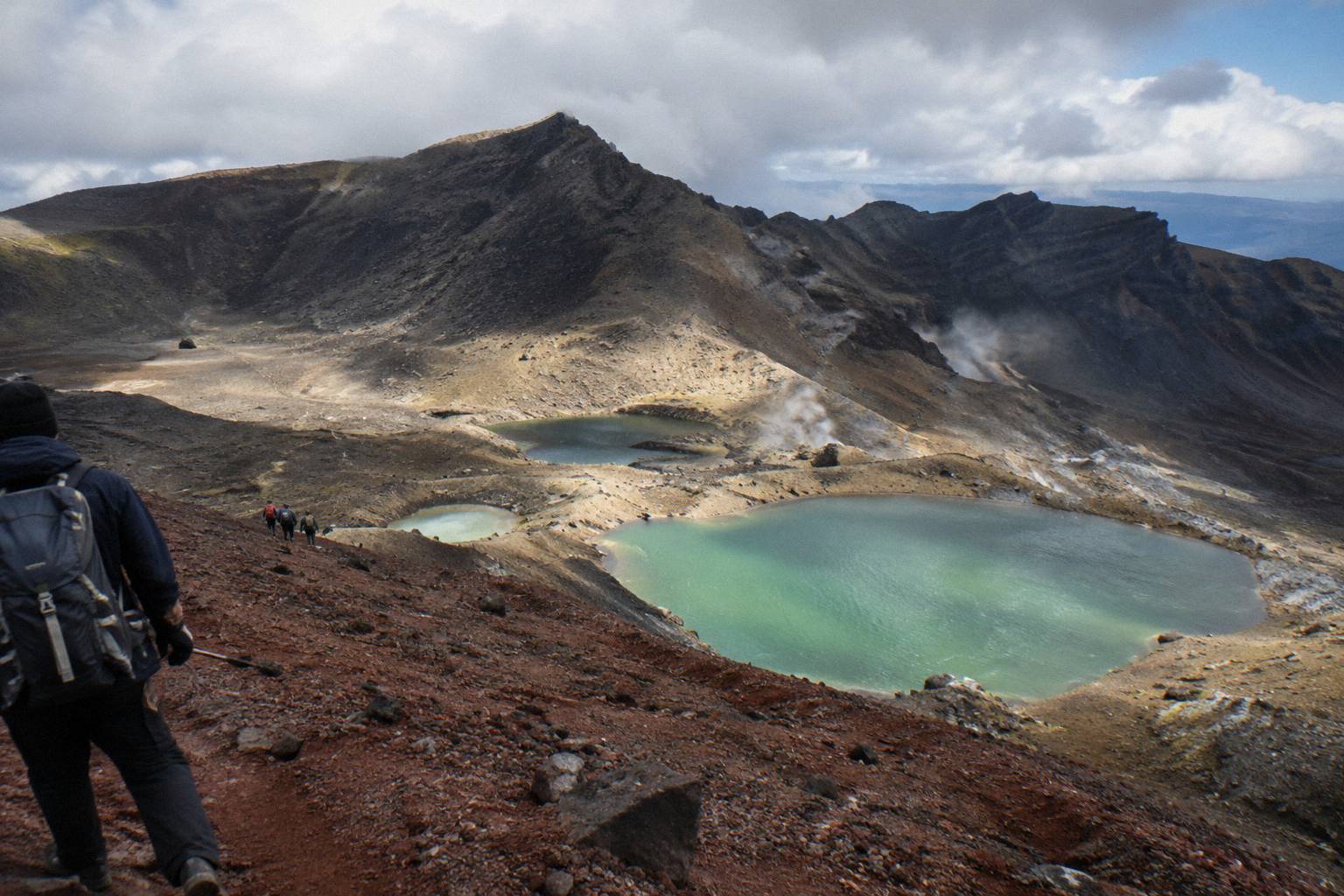
Cloud behaviour on the Crossing follows a few repeatable patterns. Morning cloud often sits in the valleys and around the Mangatepopo start while the higher ridge is clear, which rewards an early start. Mid to late morning is frequently the clearest window for the Red Crater section. Afternoon brings convective cloud, when the sun heats the plateau and cumulus builds against the ridge, and this is the cloud that can suddenly swallow the view between Red Crater and the lakes. None of these patterns is a promise, but they shape most fine-season days.
Visibility also affects navigation, not just photography. In thick cloud the junctions between the South Crater, the Red Crater climb and the Central Crater crossing are less obvious than they are in clear air, and the poled route matters more. In winter, cloud plus snow smooths the terrain so completely that the track line can vanish. DOC's winter grading, an Expert route where alpine skills are essential and going with a guide is best, exists for that combination, and it is not a grading to talk your way around.
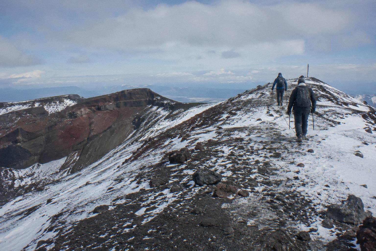
For photographers, the practical advice is to plan for light rather than for a perfect sky. The lakes' colour, which comes from dissolved minerals leaching from the surrounding thermal ground, reads best with side light or broken cloud, and flat grey can dull it even in clear air. The photographing the Emerald Lakes guide covers the angles; the weather takeaway is simply that broken cloud is often better than blue, and that the cloud that ruins your view from the rim may be gone by the time you reach the lakes themselves.
One request travels with the view: Kaumatua Te Ngaehe Wanikau asks visitors to respect the maunga tapu, the sacred mountain, by not touching or entering any of the waterways, including the alpine lakes. That rules out swimming or wading in the Emerald Lakes regardless of the weather. The swimming in the Emerald Lakes page covers the cultural and practical detail.
The Seasons: How Conditions Shift From November To October
DOC splits the Crossing into two weather regimes. From November to April the track is an intermediate tramping track, 7 to 8 hours, and shuttle services run. From May to October it becomes an Expert route, 9 hours, with snow, ice, avalanche risk and sub-zero temperatures, and DOC says alpine skills are essential and it is best to go with a guide. Shuttles generally do not operate in winter while guided trips include transport.
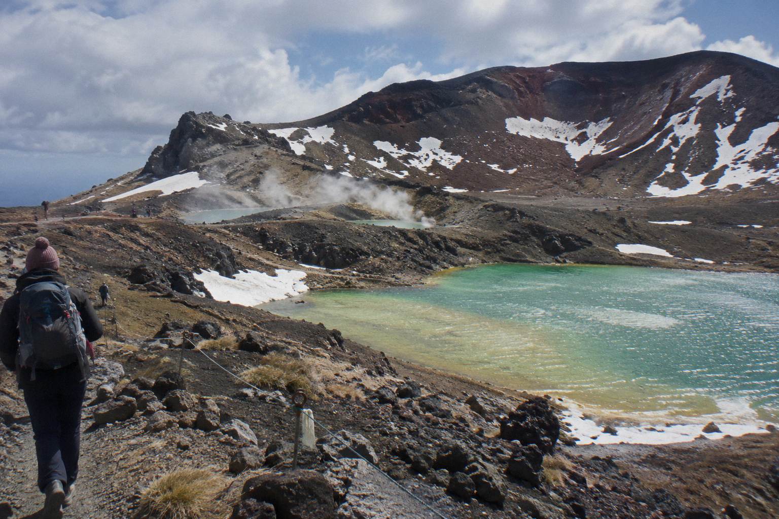
Summer, meaning November to April here, is when the whole logistics chain works. The DOC booking system is active, parking at the road ends is limited to 4 hours from Labour weekend through 30 April so DOC suggests a shuttle, and the full spread of operators runs. Wind and cloud are still the daily variables, and a summer storm can still close the track or stop a guided day, but the track itself is walkable by anyone matching DOC's High fitness grading. The trade-off is crowding on fine days and thermally driven afternoon cloud on many of them.
| Period | DOC Track Class | DOC Time | Operating Notes |
|---|---|---|---|
| November to April | Intermediate tramping track | 7 to 8 hours | Shuttles run; 4 hour parking limit at road ends; DOC booking system free and recommended |
| May to October | Expert route | 9 hours | Snow, ice, avalanche risk; shuttles generally do not run; guided trips include transport |
Winter, May to October, is a different sport. DOC's winter essentials for independent trips list crampons, ice axe, helmet, avalanche gear and the competency to use them. Volcanic alert levels and avalanche danger both change daily, and the daylight window narrows to the 9 to 11 hours DOC notes for winter. For walkers without alpine experience, the realistic winter options are a guided day with Adrift Tongariro, whose guides carry the winter gear, or a different walk entirely. DOC names Taranaki Falls and Tama Lakes as alternatives when conditions are poor, and the other hikes in Tongariro National Park guide collects them.
The shoulder edges of each season deserve their own caution. Late October can deliver a Labour weekend start to the summer rules while the ridge still holds snow from the winter, and April can bring the first real cold fronts while shuttles are still running. The best month to hike to the Emerald Lakes page works through the month-by-month trade-offs, and the winter on the Crossing page covers the snow side in detail.
When The Crossing Does Not Run: Advisories And Operator Calls
Two different bodies can stop a Crossing day. DOC issues weather advisories on hazardous days, and operators are bound by DOC rules not to run on advisory days, so guided tours and shuttles stop together when the advisory is in place. Separately, an operator can call off its own day when the advisory is not triggered but the forecast, most often wind, is beyond its threshold. Neither is a refund dispute, it is the system working.
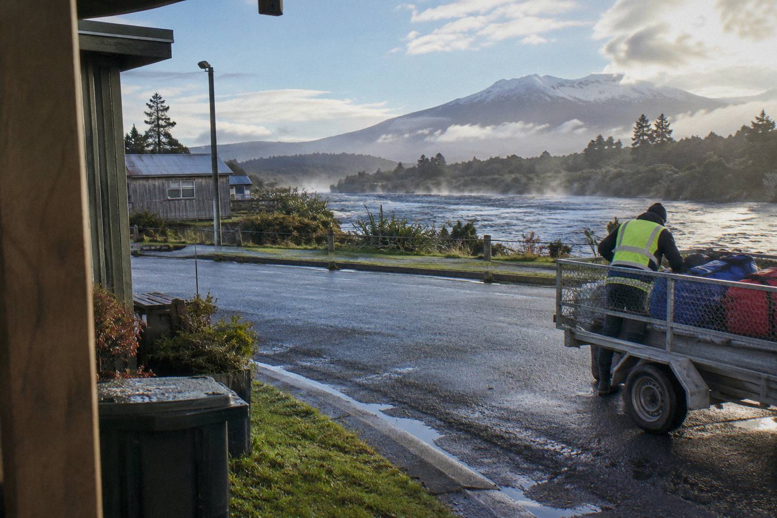
The practical implication for booking is to read the cancellation line on whatever you book. The Adrift Tongariro premium guided hike carries free cancellation up to 14 days before, which suits a planned trip. Most shuttles, including the Tongariro Crossing Shuttles round-trip from National Park Village at from NZ$75 per person and the Tongariro Expeditions Crossing shuttle from Taupo or Turangi at from NZ$75 per person, carry free cancellation up to 24 hours before. The Adrift private guided Crossing and the ExperienceKart three-day tour are non-refundable, so a weather-driven change on those is a cost question, and the booking page shows the terms.
A cancelled day does not have to be a lost day. DOC points to Taranaki Falls and Tama Lakes as the standard alternatives, both reachable from the Whakapapa side of the park and both unaffected by the alpine advisory system. The is the Crossing open page explains how to read the alert system in detail, and the rule of thumb is simple: check the DOC page for the advisory, check your operator's call, and never treat a blue sky in Taupo as evidence of anything.
If your dates are fixed and your forecast is marginal, a Taupo or Turangi based shuttle buys flexibility rather than protection. The Tongariro Expeditions Crossing shuttle from Taupo or Turangi, rated 4.7 across 431 reviews, runs an 8 to 10 hour day and offers free cancellation up to 24 hours before, so a bad forecast costs you nothing if you pull the pin in time.
Choosing Between A Shuttle And A Guide When The Forecast Is Uncertain
If the forecast is settled and you are comfortable on an intermediate tramping track, a shuttle is the cheaper and simpler structure. If the forecast is marginal, if you are walking outside the November to April window, or if you want the weather call made by someone who runs the track in all seasons, a guided day is what buys that judgment. Shuttles are transport only and never guided, and guided days are never cheap.
The shuttle menu is broader than most visitors expect, and the departure point is the main divider. From National Park Village, the Tongariro Crossing Shuttles round-trip runs from NZ$75 per person with free cancellation up to 24 hours before, and it is the most reviewed tour here at 4.7 across 890 reviews. The Dempsey Buses return bus from National Park Village, 4.8 across 72 reviews, runs from NZ$90 per person and excludes children under 6. From the Ketetahi side, the one-way park-and-rides including Ruapehu Scenic Shuttles and Owhango Adventures are a different structure again: you park at the Ketetahi car park and ride to Mangatepopo, with no return leg.
| Tour | Type | Departure | Price | Rating |
|---|---|---|---|---|
| Tongariro Crossing Shuttles round-trip | Shuttle, return | National Park Village | From NZ$75 | 4.7 across 890 reviews |
| Dempsey Buses return bus | Shuttle, return | National Park Village | From NZ$90 | 4.8 across 72 reviews |
| Tongariro Expeditions Taupo/Turangi shuttle | Shuttle with transfers | Taupo, Turangi or Ketetahi | From NZ$75 | 4.7 across 431 reviews |
| Ruapehu Scenic Shuttles Ketetahi park-and-ride | Shuttle, one-way | Ketetahi car park | From NZ$68 | 4.8 across 670 reviews |
| Backyard Tours mountain shuttle from Turangi | Shuttle | Turangi | From NZ$120 | 3 reviews so far |
| Adrift Tongariro premium guided hike | Guided group hike | National Park Village | From NZ$450 | 4.6 across 242 reviews |
The guided side is Adrift Tongariro, which runs three guided tours: the premium guided hike from NZ$450 per person with free cancellation up to 14 days before, a full-day guided group walk with no price printed here, and a private guided Crossing. The private version, 4.5 across 30 reviews and non-refundable, suits small groups who want the guide to themselves and are confident enough in their dates to give up the cancellation window. All three reach the Emerald Lakes with a guide, run from the Adrift base at 53 Carroll Street, and include crampons and ice axes for winter conditions if required; lunch is not included, so bring your own.
The deciding question is honest self-assessment. Read the forecast, read DOC's fitness grading, and ask whether a day that turns windy above the South Crater is a day you would manage alone. The do you need a guide for the Crossing post works through that question at length, and the short version is that wind, not distance, is what usually separates the two answers.
The Dempsey Buses return bus from National Park Village is a middle option worth naming for weather-cautious walkers: a 4.8 rating across 72 reviews, from NZ$90 per person, free cancellation up to 24 hours before, a full-day return that pairs with a flexible start.
Mistakes That Catch Walkers Out On Weather Days
The recurring mistakes are all forms of trusting the wrong signal: trusting a town forecast instead of the NIWA park forecast, trusting a clear start instead of the afternoon outlook, trusting a summer grading into a winter month, and treating a shuttle as if it were a guided day. Each one is common, each is avoidable with a checklist, and the worst of them, an underprepared winter attempt, is the one DOC's Expert grading exists to stop.
The first mistake is planning around the town you sleep in. Weather in Taupo, Turangi or Ohakune is valley weather, and the Crossing ridge is a different elevation band with its own forecast. The second is ignoring the afternoon: many walkers start in the best window of the day and then meet strengthening wind and building cloud on the Red Crater section, precisely because an early start was the right call for the climb and the wrong call for the weather. Check the morning and the afternoon in the NIWA forecast, not just the day's headline.
The third mistake is gear that matches the car park rather than the summit. The 1120 m start can feel mild while the 1886 m rim is near freezing in wind, and the temperature drop with height does not need a storm, just altitude. The what to wear hiking to the Emerald Lakes guide covers layers in detail; the weather logic is that a shell, warm layer and gloves belong in the pack on almost every Crossing day, including fine-looking summer ones.
| Mistake | What Happens | The Fix |
|---|---|---|
| Using a Taupo or Ohakune town forecast | You dress for valley conditions, not the ridge | Use the NIWA Tongariro National Park forecast |
| Checking only the morning outlook | Wind and cloud build on the Red Crater section after midday | Read morning and afternoon bands |
| Booking a shuttle and expecting guide-level support | Shuttles are transport only, never guided | Book an Adrift guided day if you want the weather call made for you |
| Parking at the road end in the summer season | The 4 hour maximum from Labour weekend to 30 April does not fit a 7 to 8 hour walk | Book a shuttle, as DOC suggests |
| Extending a summer plan into May | The track becomes an Expert route with snow and ice | Shift dates or book a guide |
| Treating the Emerald Lakes as a swim stop | The cultural request is not to touch or enter any waterways | Enjoy the lakes from the shore |
The fourth mistake is structural: parking at Mangatepopo in the summer season. The walk takes 7 to 8 hours and the parking maximum is 4, so the maths fails before the weather even enters. A one-way Ketetahi park-and-ride such as the Ruapehu Scenic Shuttles option, 4.8 across 670 reviews and from NZ$68 per person, solves it cleanly, with free cancellation up to 24 hours before if the forecast turns.
The last mistake is underestimating the private option's rigidity. The Adrift Tongariro private guided Crossing, 4.5 across 30 reviews, is non-refundable, so a forecast-driven cancellation is a different conversation than it is on the free-cancellation products. If your dates are fixed and the outlook is uncertain, that trade-off belongs in the decision before you book, not after.
Common Questions About Tongariro Crossing Weather
Where Do I Check The Tongariro Alpine Crossing Weather?
Use the NIWA Tongariro National Park forecast for wind, cloud and precipitation by elevation band, the DOC Tongariro Alpine Crossing page for alerts and the seasonal grading, and GeoNet's Tongariro page for the volcanic alert level, which changes daily. Check all three the day before and again on the morning of your walk.
Is The Tongariro Crossing Weather Dangerous?
It can be. DOC grades the track High fitness, an intermediate tramping track from November to April and an Expert route from May to October with snow, ice and avalanche risk. Wind on the Red Crater ridge is the most common summer hazard, and DOC says that in winter alpine skills are essential and it is best to go with a guide.
What Is The Best Time Of Year For Good Weather On The Crossing?
November to April is the summer regime, with a 7 to 8 hour DOC walking time and shuttles running. Within that, the shoulder months often bring more settled, less crowded days than midsummer. From May to October the track becomes an Expert route, shuttles generally do not run, and only guided trips include transport.
Will My Shuttle Or Guided Tour Still Run In Bad Weather?
Operators are bound by DOC rules not to run on hazardous-weather-warning days, so guided tours and shuttles stop together when a DOC advisory is in place. An operator can also call off its own day on wind grounds. Most shuttles carry free cancellation up to 24 hours before, and the Adrift premium guided hike up to 14 days before; the booking page shows the terms for whichever day you book.
Can Cloud Ruin The Emerald Lakes View?
Yes. The lakes are seen from the Red Crater rim at 1886 m and the scree descent below it, so a cloud base at or above the rim is needed for the full view. Cloud on the ridge often moves through rather than sitting, so waiting at the top sometimes clears it. Broken cloud frequently photographs better than flat blue sky.
Do I Need To Book The DOC System As Well As A Shuttle?
Yes, in the summer season. The DOC booking system for the Crossing is free, recommended, and needed if you are taking a shuttle or a guided day. It runs alongside the parking rule: from Labour weekend in late October through 30 April, parking at the road ends is limited to 4 hours, and DOC suggests booking a shuttle.
If the forecast has you weighing dates rather than days, the sunrise start on the Crossing and summer Crossing without snow decisions pair naturally with the season guide below.