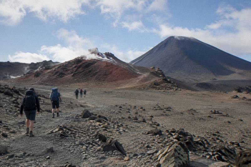
From Red Crater Down To The Emerald Lakes: The Scree Descent
The scree descent from Red Crater is the most talked-about few hundred metres of the whole Tongariro Alpine Crossing, and it drops you straight onto the Emerald Lakes. Here is what the slope actually involves, how to walk it safely, and how a guided trip or a shuttle changes the day.
Short answer
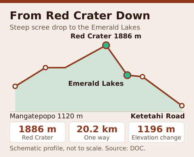
Red Crater sits at 1886 m, the high point of the 20.2 km Crossing, and the descent to the Emerald Lakes is a steep scorie slope that DOC describes as a steep scree run. DOC rates the track High fitness, 7 to 8 hours November to April and 9 hours May to October. A guided tour such as the Adrift Tongariro premium guided hike, from NZ$450 per person, includes a guide for this section.
The scree descent from Red Crater is the moment the Tongariro Alpine Crossing stops being a climb and becomes a controlled slide. One moment you are standing on the crater rim at 1886 m, the highest point of the 20.2 km track, and the next you are picking your way down loose volcanic gravel toward the three green pools DOC names Nga Rotopounamu, the Emerald Lakes. For many walkers it is the highlight of the day. For others it is the part they read about at midnight before booking anything at all. This guide covers exactly what the descent involves, how to move on scree, what the guided tours and shuttles do and does not cover, and the mistakes that trip people up on this one slope.
Adrift Tongariro runs the three guided tours available for the Crossing, including the Adrift Tongariro premium guided hike, from NZ$450 per person with free cancellation up to 14 days before. If you would rather walk independently, the Ruapehu Scenic Shuttles Ketetahi park-and-ride gets you to the Mangatepopo start from NZ$68 per person, and the Tongariro Crossing Shuttles round-trip from National Park Village runs from NZ$75 per person. None of the shuttles is guided, and none of the guided hikes is a shuttle.
If you want the full picture of the lakes themselves, see what the Emerald Lakes are on the Crossing, and for the numbers behind the whole route, distance and elevation to the Emerald Lakes breaks down every band of the climb.
Quick Facts: The Descent At A Glance
The descent is where the hike shifts gears, trading the climb for steady downhill travel that demands attention more than effort; this quick-facts section breaks down the essentials of the route down, from trail conditions and footing to timing and what to expect as you make your way back.
| Item | Figure | Source note |
|---|---|---|
| Red Crater height | 1886 m | Highest point of the track |
| Track length | 20.2 km one way | Full Crossing |
| Elevation change | +/- 1196 m | Whole track |
| Walking time Nov to Apr | 7 to 8 hours | Whole track, DOC band |
| Walking time May to Oct | 9 hours | Expert route, DOC band |
| Fitness rating | High | DOC rating |
| Season character | Summer intermediate, Expert May to Oct | DOC wording |
| Lakes rule | No touching or entering the water | Request of Ngati Hikairo ki Tongariro via DOC |
DOC publishes the official track page for the Tongariro Alpine Crossing, and that page is the authority for every figure above. Volcanic alert levels change daily, and GeoNet is the place to watch them; DOC's volcanic risk advice for the park explains how the advisory system works.
How Steep Is The Scree Descent From Red Crater?
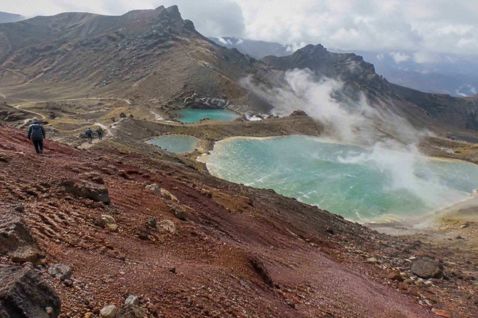
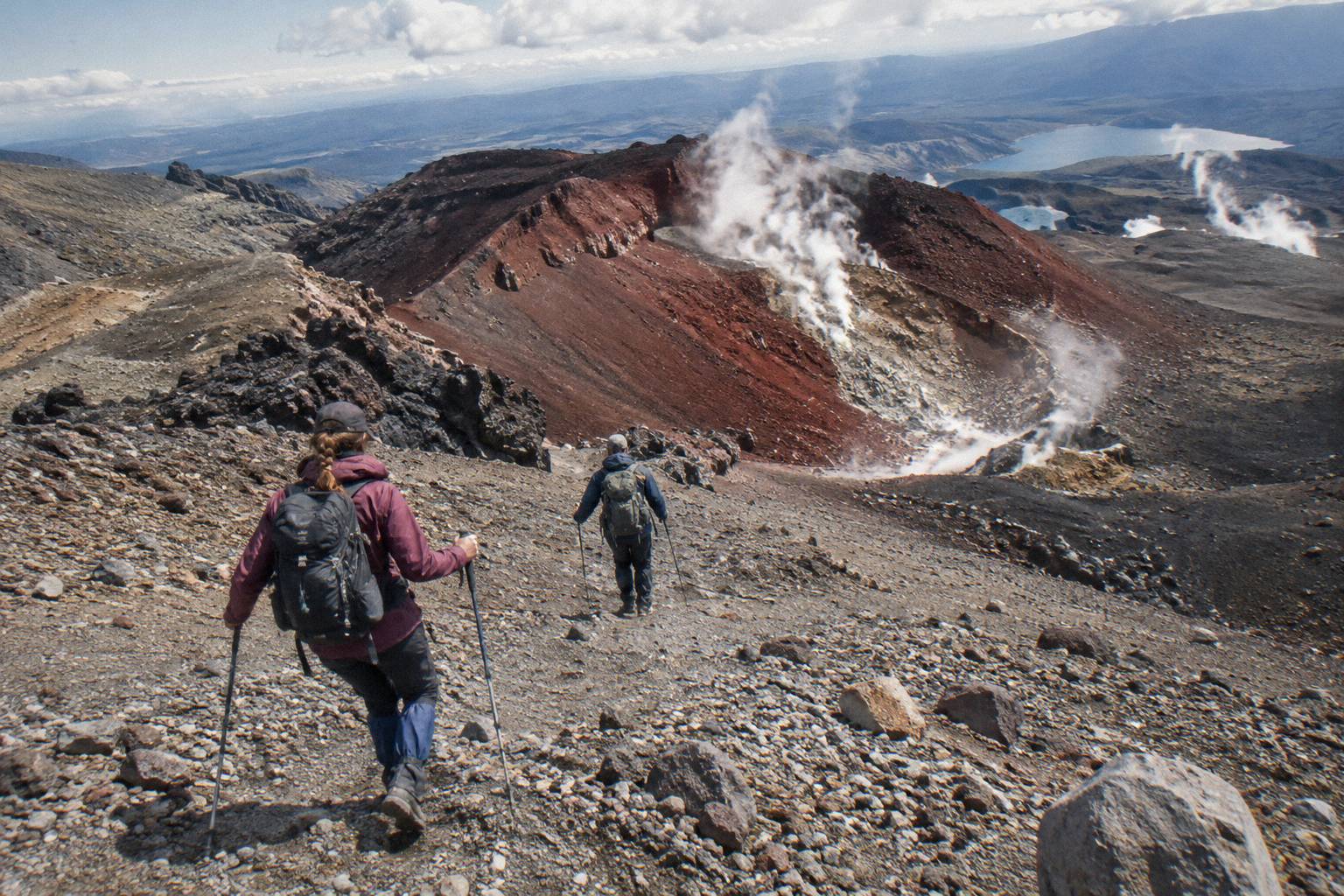
The scree descent from Red Crater is the steepest sustained section of the whole 20.2 km Crossing, dropping from the 1886 m crater rim to the basin that holds the Emerald Lakes in one continuous push of loose gravel and scoria. It is steep but not exposed, with no cliff edge beside you, so the real danger is slipping on shifting volcanic rubble rather than falling from height.
Scree is loose, rounded gravel that has weathered off the crater walls and collected on the slope below the rim. Because each particle rolls against its neighbours, your feet never sit on anything solid. Push off your toe and the whole surface slides a few centimetres before it grips. That movement is what makes the slope feel harder than its gradient alone suggests, and it is also what makes it forgiving on the knees if you let the gravel work for you instead of fighting it.
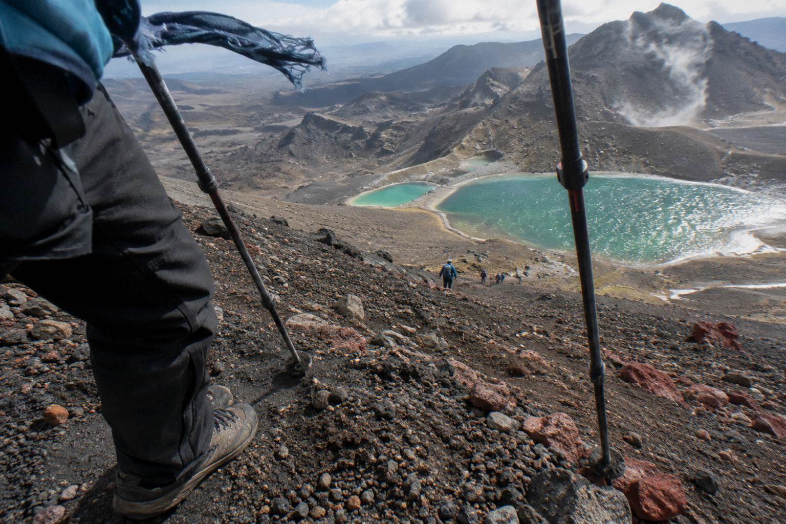
The technique that experienced walkers use is simple to describe and takes a few minutes to trust. Lean your weight back slightly, keep your steps short, and let the scree absorb each stride. Walking poles help enormously here because you can plant them wide and use them as brakes. Trying to run the slope is how most of the minor injuries on this section happen: a fast slide is fun for ten seconds and then a stone turns under a boot and the ankle pays for it.
The other thing worth knowing is that the descent looks worse from the top than it is two minutes in. From the rim the slope appears almost vertical, foreshortened by the view straight down onto the lakes. Once you commit to it the angle eases in stages, and the surface, while loose, is wide enough that walkers can pick their own line rather than queuing down a single groove. In peak season you will usually see a fan of people spread across the slope, each finding their own pace.
Time budget realistically. Most walkers clear the steep part in around 20 to 30 minutes, with a pause at the top and again at the bottom. If the whole track is a 7 to 8 hour day from November to April, the Red Crater to Emerald Lakes section is a small slice of it, but it deserves more of your attention per metre than any other part of the route because it is where concentration matters most. How long the hike to Emerald Lake takes covers the timing of the whole day.
For walkers who want the slope covered with a professional alongside, the guided option exists precisely for sections like this one.
The Adrift Tongariro premium guided hike, rated 4.6 across 242 reviews, runs from NZ$450 per person from National Park Village, with free cancellation up to 14 days before and a booked duration of 8 to 9 hours. Bring your own lunch, and note that crampons and ice axes are supplied on the guided tours if winter conditions require them. The Adrift Tongariro full-day guided Crossing, rated 4.7 across 278 reviews, covers the same ground with the same operator; its price is on the listing, and it is non-refundable, so check the terms before committing. Both are genuine guided hikes, not transport.
Is The Red Crater Descent Dangerous?
For a reasonably fit summer walker taking it slowly, the Red Crater descent is challenging rather than dangerous, and DOC rates the summer track as an intermediate tramping route with a High fitness requirement. The real dangers are seasonal: from May to October the slope holds snow and ice, DOC classes it as an Expert route where alpine skills are essential, and avalanche risk exists.
The seasonal split matters more here than on any other part of the Crossing. From November to April the scree is scree: dry, shifting rubble that a careful walker manages with short steps and poles. From May to October the same slope can be a snow chute over ice, and DOC's own wording is that alpine skills are essential and it is best to go with a guide. Sub-zero temperatures, snow, ice and avalanche risk are all listed for the winter months. Winter daylight runs 9 to 11 hours, so the margin for error shrinks too.
Volcanic hazard is the other structural consideration. The 2012 Te Maari eruption on the northern slopes of Tongariro is recent history, and volcanic alert levels are assessed daily rather than being a fixed property of the mountain. The advisory system is what governs whether operators run: guided operators and shuttles run only when DOC's advisory and the forecast allow, conditions allowing. That is why no honest article can promise the walk goes ahead on any given day.
If a guided day sounds right for this slope, the Adrift Tongariro premium guided hike is the one to weigh first. It includes transport from the base at National Park Village, a guide across the whole route including the descent, and winter gear if conditions require it. Pickups from Taupo, Turangi and Whakapapa are possible at a surcharge on private trips, and the booking page shows the age limits.
For independent walkers, the weather question is answered honestly in Crossing weather above the Emerald Lakes, and DOC's booking guidance, free and recommended, is on the official Crossing booking system page.
What Does The Descent Look Like Underfoot?
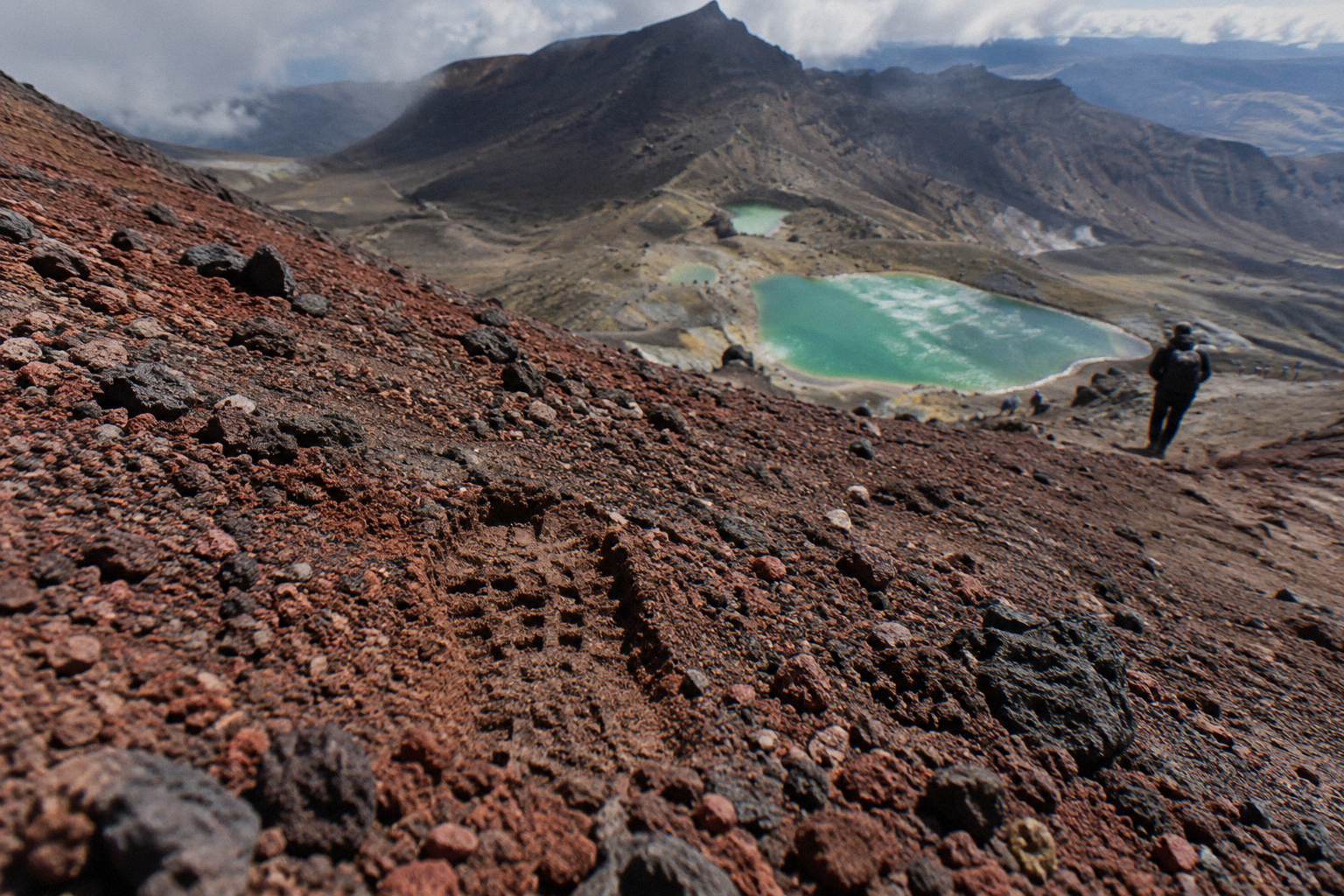
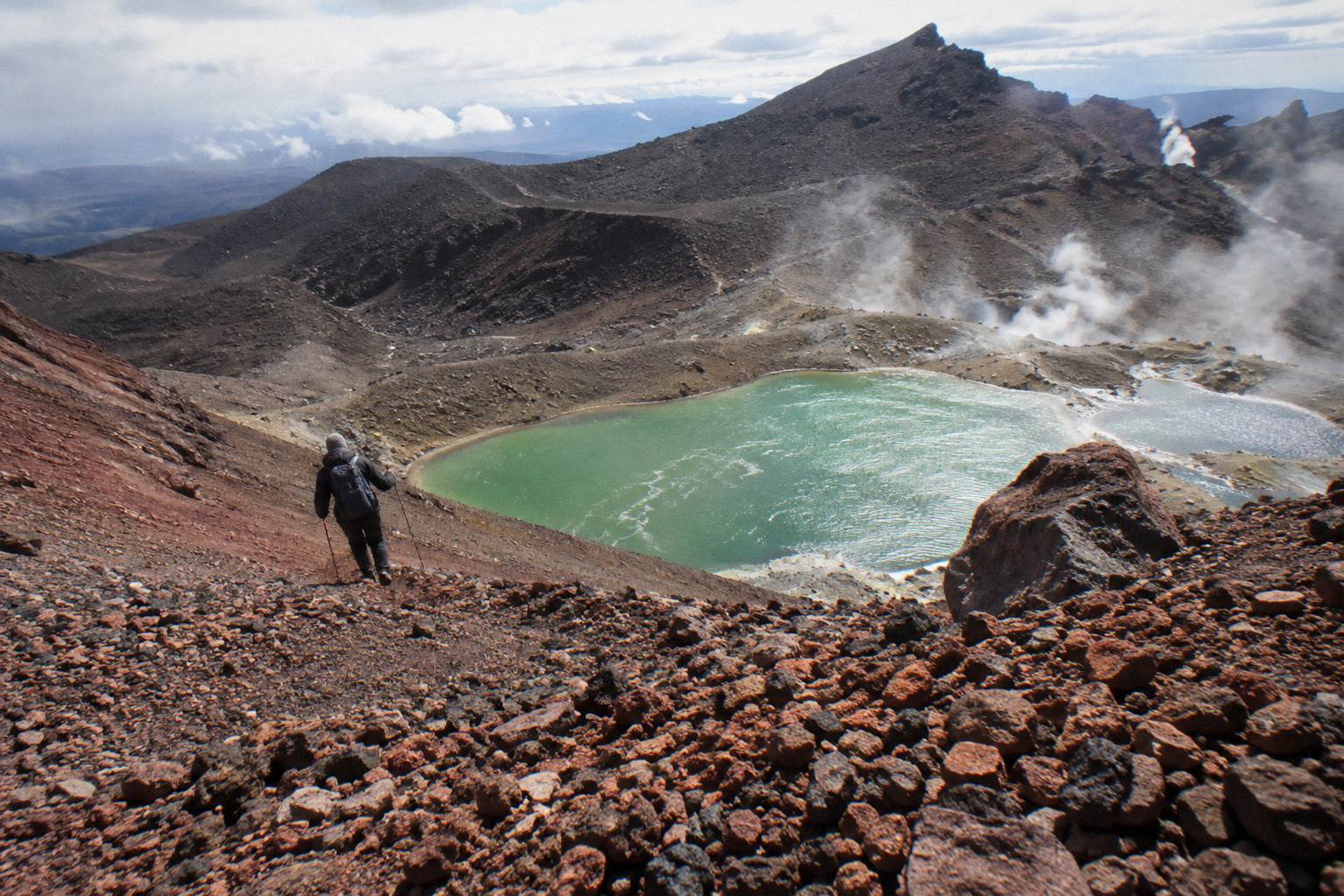
Underfoot, the descent is loose red and black scorie gravel sitting over hard-packed substrate, spreading into a broad fan rather than a single path, with stones that roll beneath every step. The centre of the fan is the deepest and loosest ground, while the edges stay firmer where fewer feet have churned them, so a stiff-soled boot with good tread beats poles, and the side of the main line is often the easiest way down.
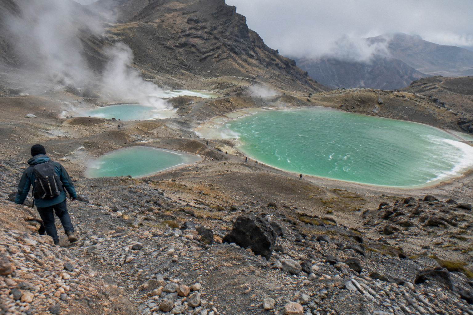
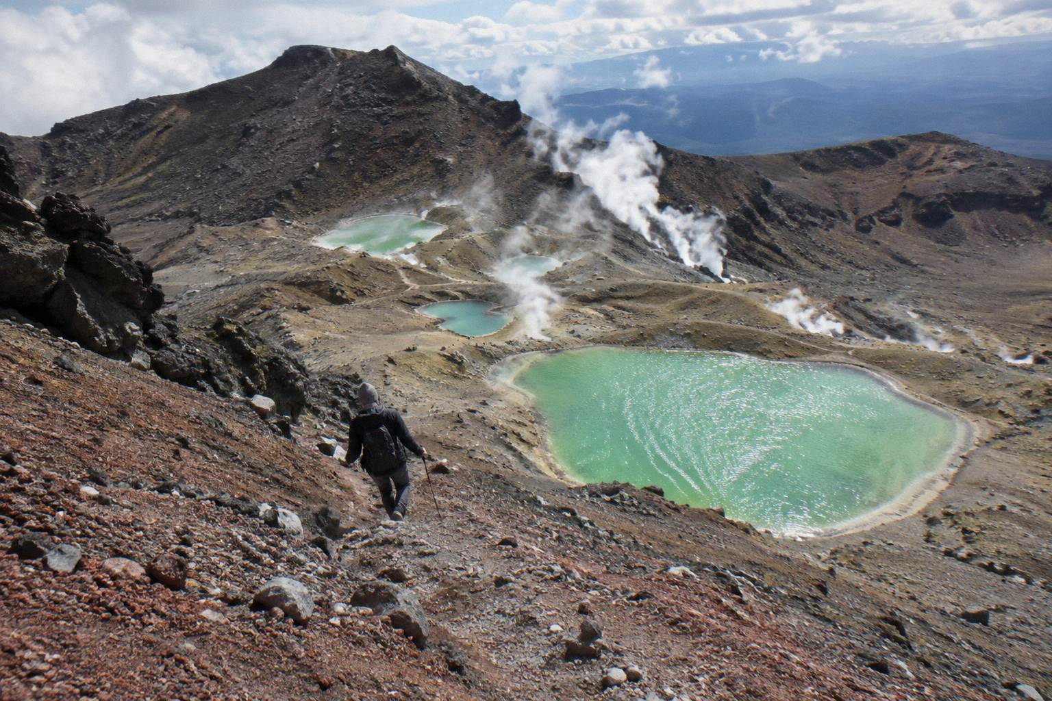
The colour is part of why people remember this section. Red Crater's walls are oxidised iron-rich rock, deep rust and orange above, and the gravel below runs from brick red through to charcoal black as you descend toward the thermal basin. Steam rises from vents on the far side, and the Emerald Lakes appear below as the payoff, their green the result of minerals washed down from the thermal area. Why the Emerald Lakes have their colours explains the chemistry, and photographing the Emerald Lakes covers where to stand for the shot once you are down.
Practically, three things decide how the slope feels under your boots. Sole stiffness first: a flexible shoe lets every stone print into your foot, while a stiffer boot or hiking shoe spreads the load. Tread second: worn-smooth soles slide on scree that a fresh lug pattern grips. Pole placement third: two poles planted wide give you a stable triangle, and shortening them slightly for the downhill keeps your posture upright rather than pitched forward.
There is a persistent myth that you need mountaineering boots for this descent in summer. You do not. What you need is a shoe or boot with structure and tread, and the fuller argument is in whether you need hiking boots for the Crossing. Gear beyond footwear, specifically crampons and ice axes, is stated as supplied only on the three Adrift Tongariro guided tours, for winter conditions if required. A winter independent trip needs DOC's full winter essentials list: crampons, ice axe, helmet, competency, and avalanche gear.
How Do You Actually Walk Down Scree Safely?
Walk down scree with your weight slightly back, short steps, knees soft, and poles planted wide as brakes, and let the gravel slide a little under each foot rather than fighting it. Pick a line toward the firmer edges of the fan, never run, and stop fully rather than half-looking when you want to take in the lakes. If a slide starts, sit down deliberately to lower your centre of gravity and stop.
The technique section deserves its own treatment because it is the difference between arriving at the lakes delighted and arriving with a wrapped ankle. Weight back is the core principle: gravity wants to pitch you forward down the slope, and leaning back slightly keeps your hips over your feet. Short steps keep each foot placement a controlled choice. Soft knees absorb the roll of stones. These three habits together turn the descent from a fight into something closer to a controlled glide. The wider set of guides lives on Tongariro Emerald Lakes Hike.
Pole technique deserves one specific note. Plant poles slightly downslope and wide of your line, not in front of your feet where they can be knocked over by sliding gravel. Use them to test the surface ahead and to take load off your knees on the steeper pitches. If you do not own poles, this is the single section of the Crossing where renting or borrowing a pair earns its cost.
Group dynamics matter more than people expect. In busy season the fan of descending walkers spreads wide, and the person above you can send stones rolling down. Keep a gap of several metres from the walker ahead, and if you knock a stone loose, call it. This is standard practice on any scree slope and marks you as a considerate walker rather than a hazard.
Finally, the lakes themselves. Ngati Hikairo ki Tongariro, through Kaumatua Te Ngaehe Wanikau, ask visitors to respect the maunga tapu by not touching or entering any of the waterways including the alpine lakes. That is a request, printed in DOC's own wording, and the right response is to enjoy the green from the shoreline. Whether you can swim in the Emerald Lakes covers the question in full.
Shuttle Or Guided Walk For The Descent Day?
Take a shuttle if you only need transport to the start and back; book one of the three Adrift Tongariro guided tours if you want an expert beside you on the scree, since every shuttle product is transport only. With DOC limiting road-end parking to 4 hours from Labour weekend to 30 April, nearly every summer walker uses a shuttle anyway, so the real choice is whether to add a guide.
The shuttle landscape splits by where you start your day. Park at Ketetahi and ride to Mangatepopo on a one-way park-and-ride: you walk the Crossing and finish at your own car, and there is no return transport in that product. The Ruapehu Scenic Shuttles Ketetahi park-and-ride is the most reviewed option of this type, rated 4.8 across 670 reviews, from NZ$68 per person with free cancellation up to 24 hours before.
Alternatively, stay in National Park Village and take a round trip. The Tongariro Crossing Shuttles round-trip from National Park Village is the most reviewed tour here at 4.7 across 890 reviews, from NZ$75 per person, free cancellation up to 24 hours before. The Dempsey Buses return bus from National Park Village is rated 4.8 across 72 reviews, from NZ$90 per person, and excludes children under 6. Both are shuttles, not guided.
From Taupo or Turangi, the Tongariro Expeditions Crossing shuttle from Taupo or Turangi is rated 4.7 across 431 reviews, from NZ$75 per person with free cancellation up to 24 hours before. The Backyard Tours mountain shuttle from Turangi runs from NZ$120 per person with free cancellation up to 24 hours before. Again, transport only.
| Product | Type | Departure | Rating | Price |
|---|---|---|---|---|
| Adrift Tongariro premium guided hike | Guided hike | National Park Village | 4.6, 242 reviews | from NZ$450 pp |
| Adrift Tongariro private guided Crossing | Guided private hike | National Park Village | 4.5, 30 reviews | Price on the booking page |
| Ruapehu Scenic Shuttles Ketetahi park-and-ride | One-way shuttle | Ketetahi car park | 4.8, 670 reviews | from NZ$68 pp |
| Tongariro Crossing Shuttles round-trip | Return shuttle | National Park Village | 4.7, 890 reviews | from NZ$75 pp |
| Dempsey Buses return bus | Return shuttle | National Park Village | 4.8, 72 reviews | from NZ$90 pp |
| Tongariro Expeditions shuttle from Taupo or Turangi | Shuttle transfer | Taupo or Turangi | 4.7, 431 reviews | from NZ$75 pp |
If Taupo is your base, note that no Taupo-based guided day trip exists, so the realistic pattern is a shuttle north and a guided day from National Park Village if you want a guide. A Taupo to Emerald Lakes day plan lays out the sequence.
The Adrift Tongariro private guided Crossing, rated 4.5 across 30 reviews, suits small groups who want the slope to themselves with a guide, price on the booking page, and non-refundable terms, so read the cancellation rules carefully before booking.
For pure logistics from the Ketetahi side, the Ruapehu Scenic park-and-ride is the simplest version of the park-at-the-finish pattern.
What Comes After The Emerald Lakes?
After the Emerald Lakes the track crosses the flat Central Crater, climbs a short rise to Blue Lake, then descends the northern slopes to Ketetahi Road at about 760 m. The knee-jarring second half of the day is this descent, not the scree, and it is where tired legs and hot afternoons catch up with walkers who spent everything on Red Crater.
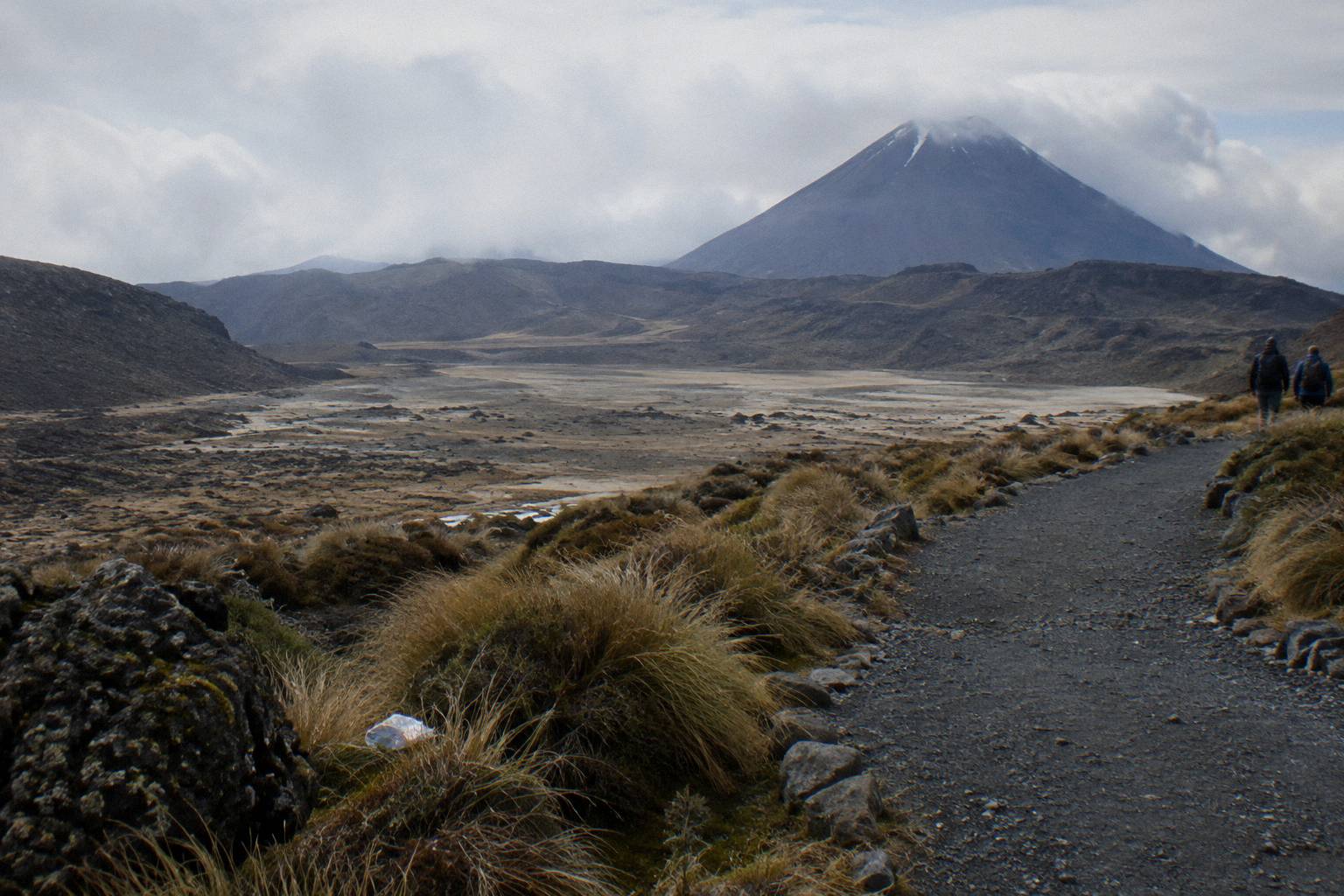
Central Crater is a wide, grey valley that feels lunar after the colour of the lakes, and it gives you a gentle recovery band before the track rises again. The Blue Lake sits in its own basin above, also tapu and also view-only under the same request. From there the track turns north and drops toward the Ketetahi thermal area, with steam plumes below and Lake Rotoaira and, on a clear day, Lake Taupo spread out to the north.
The Ketetahi descent is long zigzags on a benched track, easier underfoot than the scree but relentless on the knees over many kilometres. This is where the morning's work is paid for. Walkers who found Red Crater thrilling sometimes describe the spur as the hardest psychological stretch of the day simply because it keeps going. The Ketetahi finish after the Emerald Lakes covers the whole run down, and the crossing of Central Crater fills in the section between.
Timing the whole day matters because the descent comes after the high point, not before. DOC's band for the full track is 7 to 8 hours in the November to April season. An early start is the standard advice, and what time to start the Crossing explains why without pretending there is a single right answer. The one number that is fixed is daylight, and winter daylight of 9 to 11 hours is the tightest constraint outside the summer season.
Mistakes That Trip People Up On The Scree
The four mistakes that cause most trouble on this slope are running the scree, wearing smooth or flimsy footwear, treating the lakes as a swimming spot, and underestimating how much the day's remaining kilometres take out of the legs after the descent. Each is avoidable with a decision made before the walk, not during it. A fifth, booking a shuttle expecting a guide, is a paperwork error rather than a walking one.
Running the scree is the classic. It looks fun, and for a few seconds it is, until a stone rolls under a foot at speed. The injuries on this slope are almost all ankle rolls and falls onto outstretched hands, and almost all of them happen to people moving faster than the surface allows. Decide before the rim that you will walk it, and the temptation dissolves.
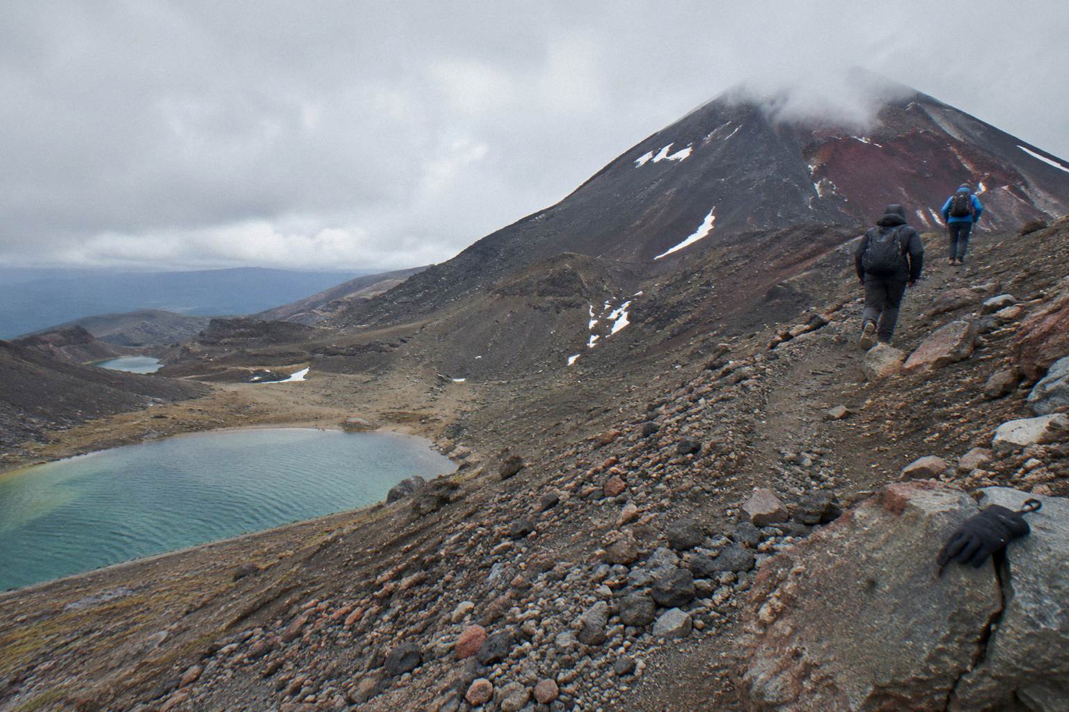
Footwear is decision two. The slope punishes worn tread and rewards structure. If your shoes are close to bald, replace or rent before the day. Decision three is the waterways rule: the request from Ngati Hikairo ki Tongariro, in DOC's wording, is not to touch or enter any of the waterways including the alpine lakes. Treat both the Emerald Lakes and the Blue Lake as look-only. Decision four is energy management: save something for the Ketetahi spur, because half the track's distance still sits below the lakes.
The paperwork mistake is expecting a shuttle to be guided. Shuttles move you, guides guide you. The Owhango Adventures Ketetahi park-and-ride, rated 4.8 across 333 reviews with free cancellation up to 24 hours before, is transport, as is the Tongariro Crossing Car Park secure parking and one-way shuttle, which has a single review so far. Neither includes a guide, and neither is a return product. If you want someone beside you on the loose ground, that is one of the Adrift Tongariro guided tours.
The Adrift Tongariro full-day guided Crossing, rated 4.7 across 278 reviews, departs National Park Village with a booked duration of 9 hours, price on the booking page, non-refundable. Its cancellation terms are on the booking page, and they differ from the premium product's 14 day window, so match the product to your plans rather than assuming one rule fits all.
Weather, Season And When The Descent Changes Character
From November to April the descent is a dry, loose summer slope on an intermediate tramping track; from May to October it becomes part of an Expert route with snow, ice, avalanche risk and sub-zero temperatures, where DOC says alpine skills are essential and a guide is best. The slope itself never closes on a schedule, but operators run only when DOC's advisory and the forecast allow, conditions allowing, and volcanic alert levels change daily.
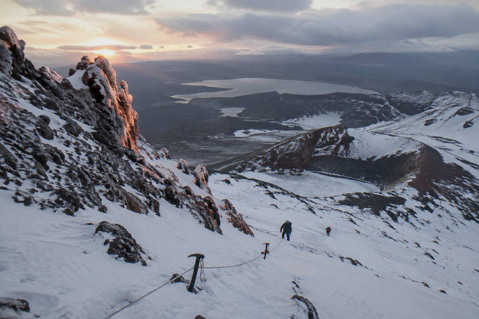
The seasonal boundary is the single most important planning fact on this page. A walker fit enough for the summer Crossing is not automatically equipped for the winter one. The winter route demands crampons, an ice axe, a helmet, competency, and avalanche gear for independent trips, in DOC's own wording. On the Adrift guided tours, crampons and ice axes are supplied for winter conditions if required, which is why a guided day is the standard recommendation outside the summer season.
No honest guide can promise the walk goes ahead. Weather calls are assessed each morning against the advisory and the forecast, and shuttles generally do not operate through winter, May to late October, while guided trips include transport. When conditions rule the Crossing out, DOC suggests Taranaki Falls and Tama Lakes as alternative walks in the same park. What to do when the Crossing closes and whether the Crossing is open cover the mechanics of status checks, and NIWA's Red Crater forecast plus the MetService mountain forecast are the two specialist tools, with avalanche.net.nz the winter reference.
Parking tightens the same seasonal calendar. From Labour weekend in late October through to 30 April, DOC applies a 4 hour maximum at the road ends and suggests booking a shuttle, and there is no summer Crossing parking at Mangatepopo car park, with a private car park near Ketetahi. In practice, summer walkers arrive by shuttle almost without exception, which is why the shuttle products above carry review counts in the hundreds.
| Season | Track standard | Descent character | Key considerations |
|---|---|---|---|
| November to April | Intermediate, High fitness | Dry loose scree | 4 hour parking limit, shuttle advised, 7 to 8 hr day |
| May to October | Expert, alpine skills essential | Possible snow and ice over scree | Avalanche risk, sub-zero cold, guide recommended, 9 hr day |
Choosing Your Day: The Short Version
Choose a guided Adrift Tongariro tour if you want expertise on the scree, winter capability, and transport from National Park Village, with the premium hike from NZ$450 per person and a 14 day free-cancellation window; choose a shuttle, from NZ$68 per person with a 24 hour cancellation window, if you are confident on loose ground and just need the logistics. Neither can promise the weather, and both run conditions allowing.
The premium guided hike is the flagship: 4.6 across 242 reviews, 8 to 9 hours booked, hotel pickup not included, lunch not included so bring your own. The private guided Crossing, 4.5 across 30 reviews, buys exclusivity at a price shown on the booking page, non-refundable. On the shuttle side, the round-trip Tongariro Crossing Shuttles product at 4.7 across 890 reviews is the most reviewed tour here, and the Dempsey Buses return bus at 4.8 across 72 reviews is the higher-rated but smaller-pool alternative. The Taupo and Turangi shuttles suit the southern approach.
From Auckland, the Kiwi Road Tours private transfer and the ExperienceKart private three-day tour both reach the Tongariro area, but neither is a guided Crossing: the walk is self-guided on both, with a long way to travel and an overnight or two-day structure. They suit travellers combining the Crossing with a wider itinerary rather than anyone specifically worried about the scree slope.
For the Turangi-based walker, the Tongariro Expeditions shuttle from Taupo or Turangi is the well-reviewed option at 4.7 across 431 reviews.
However you build the day, the scree itself is short. Respect it, walk it deliberately, keep the lakes untouched, and it will likely be the section you talk about longest after the boots come off. The wider route context sits in the Crossing map with the Emerald Lakes if you want to see where every piece fits.
Common Questions About The Red Crater Descent
How Steep Is The Descent From Red Crater To The Emerald Lakes?
The descent is the steepest sustained section of the 20.2 km Crossing, dropping from the 1886 m crater rim to the lake basin on loose scree. It is steep but not exposed: there is no cliff edge, only shifting gravel. Most walkers take roughly 20 to 30 minutes on the slope.
Is The Scree Descent Dangerous?
In summer, for a fit walker going slowly, it is challenging rather than dangerous; DOC rates the summer track intermediate with a High fitness requirement. From May to October the same slope can hold snow and ice on an Expert route where DOC says alpine skills are essential and a guide is best, with avalanche risk in play.
Do I Need A Guide For The Red Crater Descent?
In summer, no, if you are comfortable on loose ground and take it slowly with poles. In winter, DOC recommends a guide. Adrift Tongariro runs the three guided tours, including the premium guided hike from NZ$450 per person with free cancellation up to 14 days before.
Can I Slide Or Run Down The Scree?
Running or glissading the scree is how most minor injuries on this section happen, because stones roll underfoot at speed. Walk it with short steps, weight back and knees soft, and use poles planted wide as brakes.
Can I Swim In The Emerald Lakes At The Bottom?
No. Ngati Hikairo ki Tongariro, through Kaumatua Te Ngaehe Wanikau, ask visitors to respect the maunga tapu by not touching or entering any of the waterways including the alpine lakes. Enjoy the colour from the shoreline.
What Fitness Do I Need For The Red Crater Section?
DOC rates the whole track High fitness, with a walking time of 7 to 8 hours November to April and 9 hours May to October. The descent itself is more a matter of technique and concentration than cardio, but you reach it after the longest climb of the day.