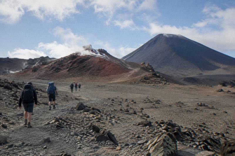
Lord Of The Rings On The Tongariro Crossing: Mount Doom Views From The Lakes
Mount Ngauruhoe, the peak used as Mount Doom in the films, stands beside the Tongariro Alpine Crossing for most of the walk, and the Emerald Lakes sit almost directly beneath it. Here is where the views are, and which tours and shuttles get you there.
Short answer
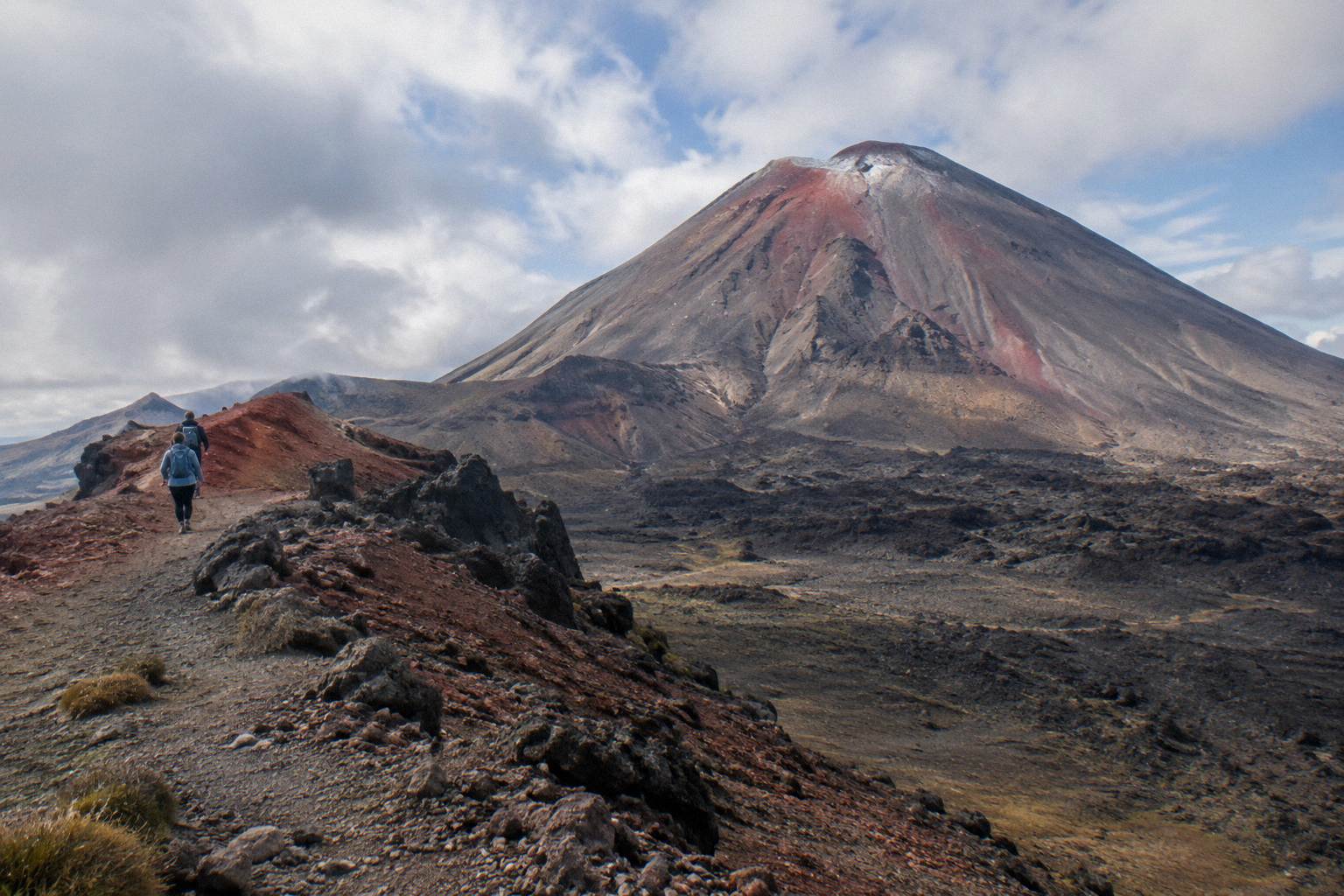
Mount Ngauruhoe is the peak used as Mount Doom in the films, and the Crossing walks right past it. The 20.2 km track climbs to Red Crater at 1886 m, then drops past the Emerald Lakes on the scree slope below Ngauruhoe's flanks. Adrift Tongariro runs the guided options, from NZ$450 per person, and shuttles from NZ$68 support a self-guided walk.
The peak that played Mount Doom in the films is Mount Ngauruhoe, and the Tongariro Alpine Crossing walks around its western and northern flanks for most of its 20.2 km length. The Emerald Lakes, the vivid green pools that give this site its name, sit on the descent from Red Crater, with Ngauruhoe's cone filling the sky to the south. You do not climb it. You walk beneath it, and the views hold for hours.
For trip planning around the mountain itself, the Tongariro Emerald Lakes Hike guide collection covers the walk section by section, from the Mangatepopo start to the Ketetahi finish.
| Quick Fact | Detail |
|---|---|
| Track length | 20.2 km one way |
| Elevation change | +/- 1196 m |
| Highest point | Red Crater, 1886 m |
| Walking time | 7 to 8 hours November to April, 9 hours May to October |
| Fitness | High (DOC rating) |
| Winter rating | Expert route May to October |
| The film peak | Mount Ngauruhoe, beside the track |
| Track authority | DOC Tongariro Alpine Crossing page |
Where Is Mount Doom On The Tongariro Crossing?
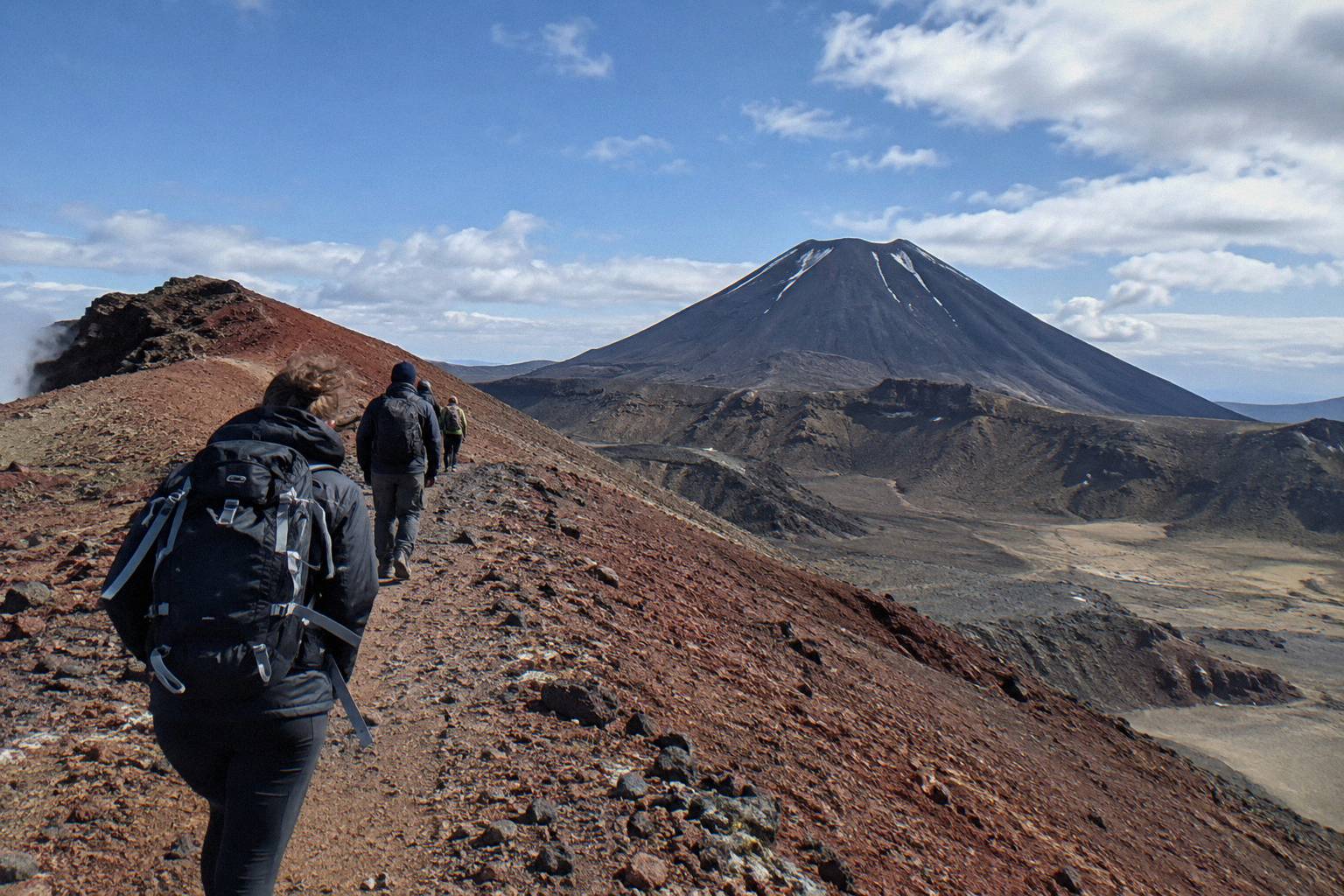
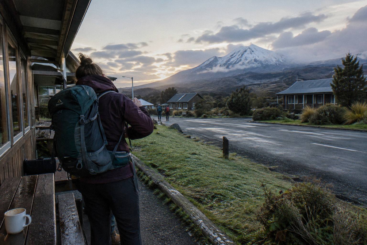
Mount Ngauruhoe is the peak used as Mount Doom in the films, and it stands directly beside the Crossing track rather than on it. The cone is visible from the Mangatepopo Valley within the first hour of walking, dominates the climb through the South Crater, and sits above the Emerald Lakes on the Red Crater descent. No tour climbs it, and the track never summits it.
That single sentence is the whole factual claim this page makes about the films, and it is the only one worth making. Everything else here is about the mountain itself. Ngauruhoe is an active volcanic cone on the flank of the older Tongariro massif, sacred to Ngati Hikairo ki Tongariro of Ngati Tuwharetoa, and the track that bears the massif's name spends its middle hours circling the cone's western and northern shoulders. The track's own high point, Red Crater at 1886 m, is a different vent on the same ridge, and Ngauruhoe's cone stands well above it.
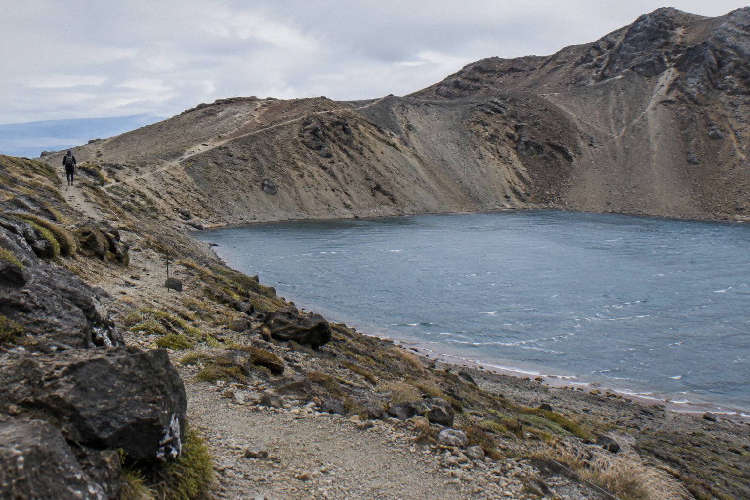
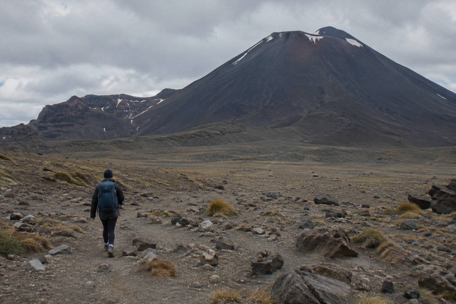
The geography rewards a moment of orientation. The Crossing runs south to north: Mangatepopo at about 1120 m, up the Devil's Staircase to the South Crater flats, over Red Crater, down the scree to the Emerald Lakes, across the Central Crater, past Blue Lake, and out the long Ketetahi descent. Ngauruhoe sits on your right shoulder for the first half and behind you after Red Crater. Film fans who want the cone in frame should be watching it on the South Crater approach and from the Red Crater ridge, where the full silhouette reads most clearly against the sky.
What the Crossing does not offer is a summit. No product in this site's tour set climbs Ngauruhoe, and the track's side trips stop at Tongariro's own ridgeline. Readers planning around "standing on Mount Doom" should plan instead around standing beneath it, which the track does superbly and at length. The Mount Ngauruhoe side trip question is covered elsewhere in this collection.
Which Tours Actually Get You The Mount Doom Views?
Only guided crossings reach the views with a guide attached, and Adrift Tongariro runs the three guided tours. Shuttles, including the Ruapehu Scenic Shuttles Ketetahi park-and-ride and the Tongariro Crossing Shuttles round trip from National Park Village, support the same walk self-guided at lower cost. Every one of them travels the same track past the same mountain.
The distinction matters more than the marketing suggests. The track is the track: whether you walk it with an Adrift guide or ride a shuttle to the Mangatepopo end and walk alone, Ngauruhoe appears in the same places at the same hours. What changes is support, gear and interpretation. The Adrift Tongariro premium guided hike, from NZ$450 per person, rated 4.6 across 242 reviews, supplies crampons and ice axes for winter conditions if required, and offers free cancellation up to 14 days before. The Adrift Tongariro full-day guided Crossing carries a 4.7 rating across 278 reviews. Departure for both is National Park Village at 53 Carroll Street, with Taupo, Turangi and Whakapapa pickups at a surcharge on private trips.
Shuttle walkers trade the guide for price and independence. The Tongariro Crossing Shuttles round-trip from National Park Village runs from NZ$75 per person, rated 4.7 across 890 reviews, and is the most reviewed tour here. The Ruapehu Scenic Shuttles Ketetahi park-and-ride runs from NZ$68 per person, rated 4.8 across 670 reviews, on a one-way basis: you park at Ketetahi, ride to the start, and walk back to your own car. Both are shuttles, not guided walks, and neither is a return service in the park-and-ride case.
The private option rounds out the guided set. The Adrift Tongariro private guided Crossing, rated 4.5 across 30 reviews, runs 7 to 9 booked hours with the same Emerald Lakes section, and suits walkers who want the guide's attention to themselves. It is non-refundable, so the decision deserves the same care the weather forecast does.
| Tour | Type | From (per person) | Rating | Emerald Lakes |
|---|---|---|---|---|
| Adrift Tongariro premium guided hike | Guided | NZ$450 | 4.6, 242 reviews | Yes, guided |
| Adrift Tongariro full-day guided Crossing | Guided | Price on the booking page | 4.7, 278 reviews | Yes, guided |
| Adrift Tongariro private guided Crossing | Guided private | Price on the booking page | 4.5, 30 reviews | Yes, guided |
| Tongariro Crossing Shuttles round trip | Shuttle | NZ$75 | 4.7, 890 reviews | Self-guided |
| Ruapehu Scenic Shuttles park-and-ride | Shuttle, one-way | NZ$68 | 4.8, 670 reviews | Self-guided |
Is A Guided Hike Worth It For The Film Views?
A guide adds nothing to the views themselves, since Ngauruhoe is visible to everyone on the track, but it adds a lot on the ridge above the Emerald Lakes in marginal weather. DOC rates the May to October route as Expert and recommends a guide outright in that window. From November to April, fit walkers with a shuttle manage the same track alone.
The honest case for guidance is timing and judgement. The Crossing's most photographed hour, the descent from Red Crater toward the Emerald Lakes with Ngauruhoe behind you, is also where the track turns steep and loose, a scorie drop DOC describes plainly as a steep scree descent. A guide reads the morning's conditions, sets the pace, and carries the equipment the season demands. Adrift Tongariro's guided tours supply crampons and ice axes for winter conditions if required, and a clothing and footwear allowance; lunch is not included, so bring your own.
The honest case against, in the summer months at least, is that the track is well formed, well walked and hard to lose. A shuttle from National Park Village or a Ketetahi park-and-ride puts a confident party on the same track for a fraction of the guided price. The is a guide worth it question gets a fuller treatment in its own guide. What guidance never changes is the mountain: Ngauruhoe stands where it stands, and the films chose it for what the Crossing shows you for free.
Where Exactly Do The Emerald Lakes Sit Beneath Mount Doom?
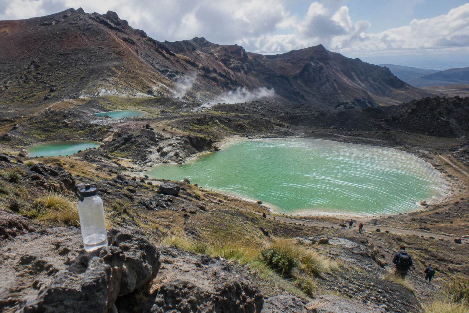
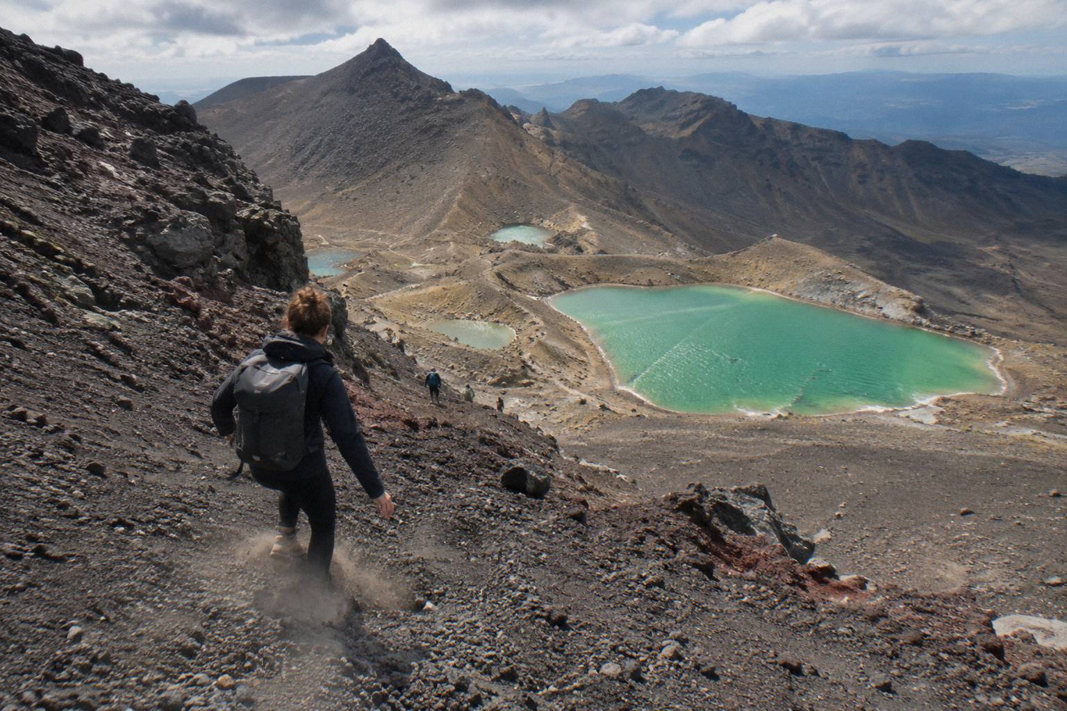
The three Emerald Lakes, Nga Rotopounamu, sit on the northern flank of Tongariro in the basin immediately below Red Crater, about 12 km into the walk from Mangatepopo. They occupy old explosion craters, and their colours come from minerals washed down from the thermal area above them. Ngauruhoe rises behind and above them to the south.
The moment is the reason many people book the day. You top out on Red Crater's ridge at 1886 m, the track's high point, and the lakes appear almost vertically below on the far side of the scree slope. DOC's own track notes single out the descent, the vivid Nga Rotopounamu-Emerald Lakes, as a highlight of the crossing. The composition works in both directions: looking down onto the green pools with the red crater wall behind, or pausing at the lakes themselves and turning to see Ngauruhoe's cone stacked above the Central Crater rim.
One request governs the lakes, and it comes from the mountain's people. Kaumatua Te Ngaehe Wanikau asks visitors to respect the maunga tapu by not touching or entering any of the waterways including the alpine lakes. That rules out swimming, paddling and any contact with the water, and it is printed on DOC's page for the track. The swimming question is answered fully in its own post; the short version is that the request is cultural, it is DOC-published, and the answer is no.
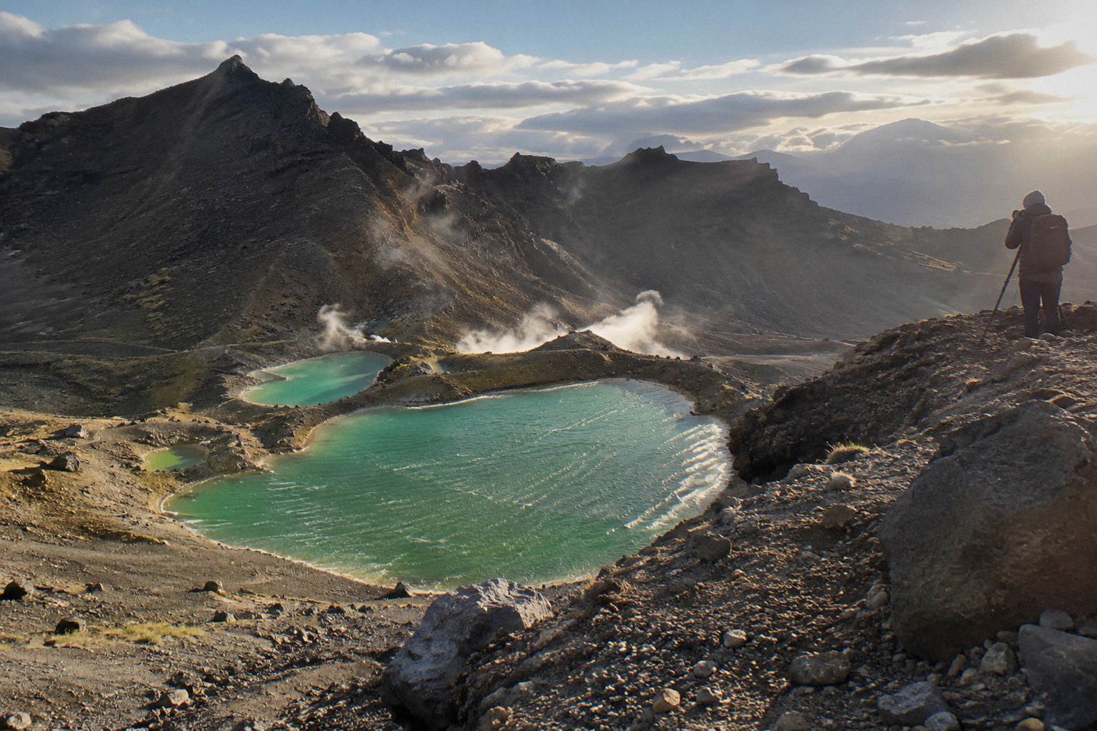
Photographers should plan the light. The lakes sit in a basin that loses direct sun in the afternoon as the ridge above them shadows the water, and the most even colour reads late morning. The photographing the Emerald Lakes guide covers compositions and timing in detail.
How Hard Is The Walk To The Mount Doom Views?
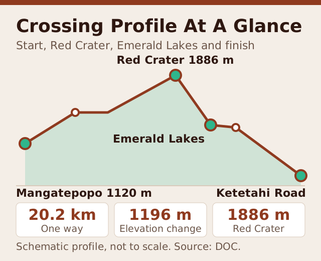
DOC rates the fitness requirement High and grades the track intermediate in the November to April season, with a walking time of 7 to 8 hours over 20.2 km and +/- 1196 m of elevation change. From May to October it becomes an Expert route where DOC says alpine skills are essential and it is best to go with a guide, with a 9 hour time estimate.
The numbers deserve respect rather than fear. The first half is the harder half: the Devil's Staircase from the Mangatepopo Valley to the South Crater rim is a sustained climb on formed steps, and the pull from the flats to Red Crater is steeper and looser. After the Emerald Lakes the track undulates across the Central Crater, skirts Blue Lake, and settles into the long, knee-testing descent toward Ketetahi Road at about 760 m. Most walkers find the second half faster than the first.
Fitness preparation is straightforward: hill walking, in the boots you will wear, in the months before the trip. The fitness for the climb guide breaks the track into training-relevant segments. Winter is a different proposition entirely, with snow, ice, avalanche risk and sub-zero temperatures in DOC's own framing, and crampons, an ice axe and competency listed among the essentials for independent trips. Adrift Tongariro's guided tours supply that gear when winter conditions require it.
What Does The Trip Cost, And Do You Need To Book?
The track itself is free, and DOC's booking system for the Crossing costs nothing, though DOC recommends it and shuttle and guided products require it. Around the free walk, shuttles run from NZ$68 per person and guided crossings from NZ$450 per person. Parking restrictions between Labour weekend and 30 April push most summer walkers onto one of those services anyway.
The parking rule is the quiet driver of almost every booking. From Labour weekend in late October to 30 April, a 4 hour maximum applies at the road ends, and DOC suggests booking a shuttle; DOC also states there is no parking for Crossing walkers at Mangatepopo car park in summer, with a private car park near Ketetahi. A 4 hour window does not cover a 7 to 8 hour walk, so the arithmetic makes itself. Part of a shuttle fee, about NZ$40, goes to conservation, in DOC's own framing of the arrangement.
| Cost Item | Typical Range | Notes |
|---|---|---|
| The track | Free | DOC booking system free and recommended |
| One-way park-and-ride shuttle | From NZ$68 | Ruapehu Scenic Shuttles, 24 hour free cancellation |
| Return shuttle, National Park Village | From NZ$75 | Tongariro Crossing Shuttles, from NZ$90 for Dempsey Buses |
| Shuttle from Taupo or Turangi | From NZ$75 | Tongariro Expeditions, 8 to 10 booked hours |
| Turangi mountain shuttle | From NZ$120 | Backyard Tours, 24 hour free cancellation |
| Guided crossing | From NZ$450 | Adrift Tongariro premium, 14 day free cancellation window |
The wider cost picture, including gear and accommodation, is laid out in the how much does the Crossing cost post. What the table above adds is the shape of the decision: the shuttle-versus-guided gap is roughly a factor of six, and the guided side buys gear, judgement and company on the high ridge.
Bookings for the season's peak months, particularly the summer school holidays, tighten early for both shuttles and guided groups. The booking page shows the cancellation terms for each product; most shuttles allow free cancellation up to 24 hours before, and the Adrift Tongariro premium guided hike up to 14 days before.
Getting there from further afield changes the product rather than the mountain. The Tongariro Expeditions Crossing shuttle from Taupo or Turangi, from NZ$75 per person and rated 4.7 across 431 reviews, covers the Taupo-based walker. DOC gives the distances: Whakapapa 10.4 km from the track, National Park 13.5 km, Turangi 36.7 km, Ohakune 48 km, Taupo 86.5 km. Auckland is a long way, and overnight products exist for it, but no Taupo-based guided day trip does; Taupo walkers ride a shuttle like everyone else.
When Should A Film Fan Plan The Walk?
The November to April window carries the full track with a 7 to 8 hour walking time and intermediate grading, while May to October is an Expert route on snow and ice where DOC recommends a guide. For open cone views of Ngauruhoe, late summer offers the most settled weather, though the mountain makes its own cloud at any time of year and no tour can promise a clear summit.
That last clause is not hedging, it is physics. Ngauruhoe is a tall volcanic cone that generates its own cap of cloud, and the Crossing's weather is assessed each morning against DOC's advisory and the mountain forecasts. Operators, guided and shuttle alike, run only when the advisory and the forecast allow. The sources to watch are DOC's Tongariro page and alerts, the NIWA forecast for the park, the MetService mountain forecast, and avalanche.net.nz in winter. Volcanic alert levels change daily and are published by GeoNet.
The seasonal trade-offs are consistent. Summer brings longer daylight, an easier track and the crowds that come with both; DOC notes winter daylight of 9 to 11 hours, which still covers the 9 hour winter estimate with little margin. Shoulder months split the difference, and the best month to hike guide works through the calendar. When conditions close the track or the day, DOC points to the Taranaki Falls and Tama Lakes walks as alternatives, both within the park and both worth a day in their own right.
What Mistakes Trip Up Mount Doom Walkers?
The recurring errors are underestimating the weather, treating the one-way park-and-ride as a return service, planning a summit that no tour offers, and touching the lakes against the published request. Each is avoidable with one piece of knowledge, and each catches otherwise well-prepared visitors every season.
The first is weather denial. The forecast at National Park Village is not the forecast at 1886 m, and the difference is routinely ten degrees and a full weather system. Check the mountain forecasts, not the town forecast, and dress for the ridge rather than the car park. The second is shuttle confusion: the six Ketetahi park-and-ride products, including the Ruapehu Scenic and Owhango Adventures services, are one-way by design. You park at Ketetahi, ride to Mangatepopo, and the walk's finish is your own car. Expecting a pickup at the far end strands walkers at the wrong trailhead.
The third is the summit assumption. No tour climbs Ngauruhoe, and framing the day around standing on the cone sets up a disappointment the track never promised. The fourth is the lakes themselves: the request not to touch or enter any waterway including the alpine lakes is DOC-published, cultural in origin, and ignored by people who assume it is a safety rule rather than a matter of respect. It is both.
The fifth, quietly, is lunch. Adrift Tongariro's guided crossings exclude lunch, and no shuttle supplies food or drink, so the day's eating is every walker's own problem. Pack for an eight hour day, not a four hour stroll.
How Do You Build The Day Around The Views?
Start early, walk south to north with a shuttle or guide handling the transport, and put the Red Crater and Emerald Lakes section in the middle hours of the day when the light is strongest on the lakes and the weather has declared itself. The classic plan is a sunrise-adjacent start from Mangatepopo with an early afternoon finish at Ketetahi.
The sequence works because of the track's shape. The climb sits in the morning when legs are fresh, the high ridge and the lakes arrive before mid afternoon, and the long Ketetahi descent, the least interesting walking of the day, fills the hours when photography matters least. An early start also beats the worst of the crowds on the Staircase and the Red Crater ridge, and the sunrise start guide covers the trade-offs in full.
Transport decides the shape more than most walkers expect. A National Park Village return shuttle, whether the Tongariro Crossing Shuttles round trip from NZ$75 or the Dempsey Buses return bus from NZ$90, rated 4.8 across 72 reviews, ties you to a pickup window at the Ketetahi end. A Ketetahi park-and-ride leaves your own car waiting at the finish and the day flexible. The guided tours fold transport into the booked day: the Adrift premium runs 8 to 9 booked hours door to door from National Park Village, the full-day guided Crossing 9 hours.
Whatever the transport, the day ends the same way: down through the Ketetahi tussock, past the steaming vents above the farm, and out to the road end with Ngauruhoe behind you. Film fans get hours of the cone, not a summit, and the hours are the better part of the bargain.
Common Questions About Lord Of The Rings On The Tongariro Crossing
Is Mount Doom A Real Place You Can Visit?
Mount Doom was portrayed by Mount Ngauruhoe, a real volcanic cone in Tongariro National Park, and the Alpine Crossing walks directly beneath it. The mountain is visible for most of the 20.2 km track, with the best views from the South Crater and the Red Crater ridge. It is sacred to Ngati Hikairo ki Tongariro, and no tour climbs it.
Do Any Tours Climb Mount Ngauruhoe?
No. No product in this site's tour set climbs the cone, and the track itself does not summit it. The Crossing passes around its flanks, and the tours that reach the views are the guided crossings run by Adrift Tongariro and the shuttles that support a self-guided walk.
Can You Swim In The Emerald Lakes Under Mount Doom?
No. Visitors are asked, through a request published on DOC's track page, not to touch or enter any of the waterways including the alpine lakes. The request comes from the mountain's people and is a matter of respect for the maunga tapu. View and photograph the lakes from the track.
Was Anything Filmed On The Crossing Itself?
This site makes no claims about filming locations beyond one fact: Mount Ngauruhoe is the peak used as Mount Doom in the films. For planning purposes, what matters is where the mountain appears on the track, which is most of the middle hours of the walk.
What Is The Cheapest Way To See Mount Doom From The Crossing?
The track itself is free, and DOC's booking system costs nothing. The cheapest supported option is a shuttle: the Ruapehu Scenic Shuttles Ketetahi park-and-ride runs from NZ$68 per person, rated 4.8 across 670 reviews, on a one-way basis with your own car waiting at the finish.
Is The Walk Safe For A First-Time Hiker?
In the November to April season the track is graded intermediate with a High fitness rating, and fit first-timers complete it regularly with a shuttle. From May to October it is an Expert route with snow and ice, where DOC says alpine skills are essential and recommends going with a guide. Check DOC's advisory before committing to a day.