Can You Swim In The Emerald Lakes On The Tongariro Crossing?
No, visitors are asked not to touch or enter the Emerald Lakes. Here is what DOC actually asks, why the request exists, and how to plan your day at the lakes.
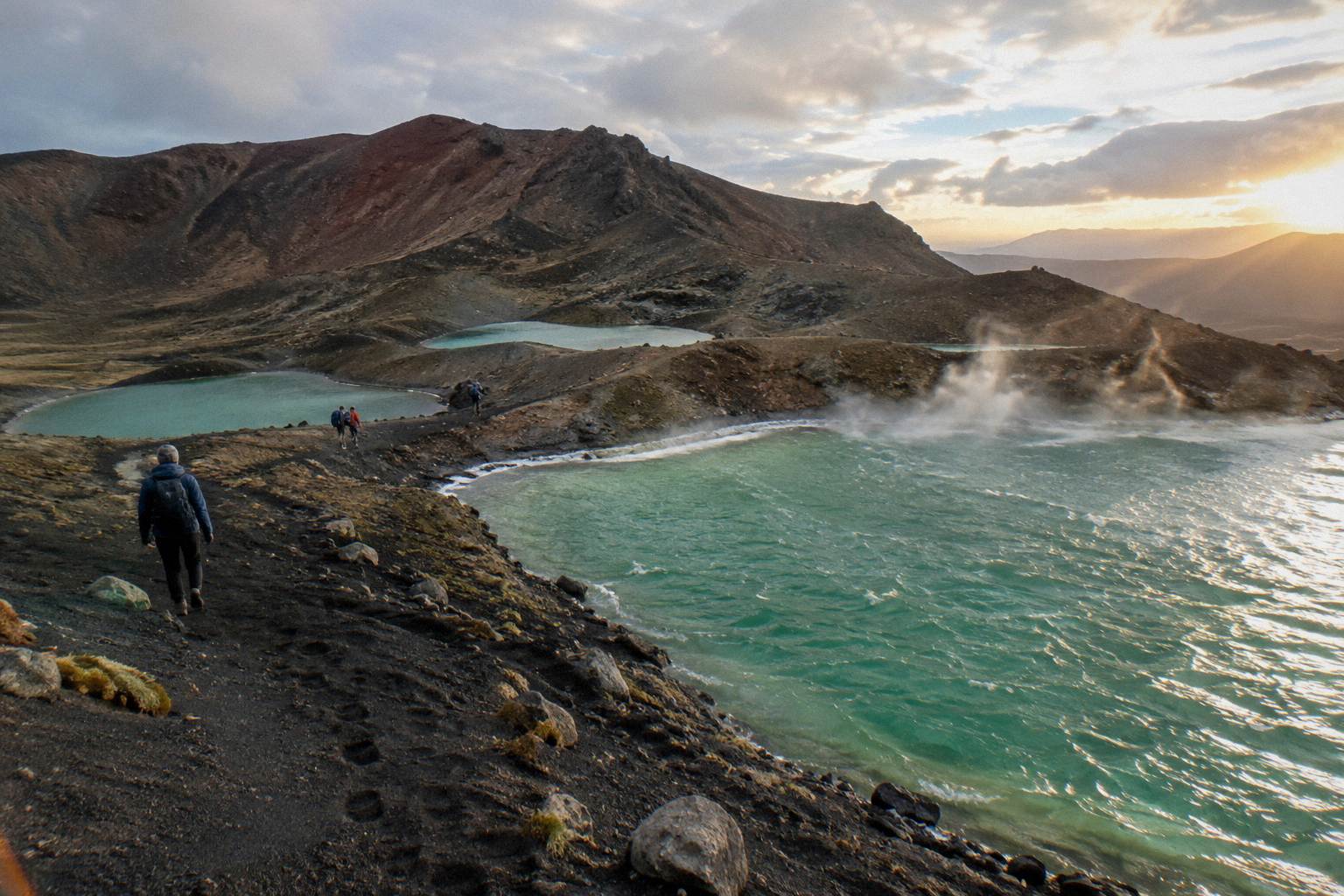
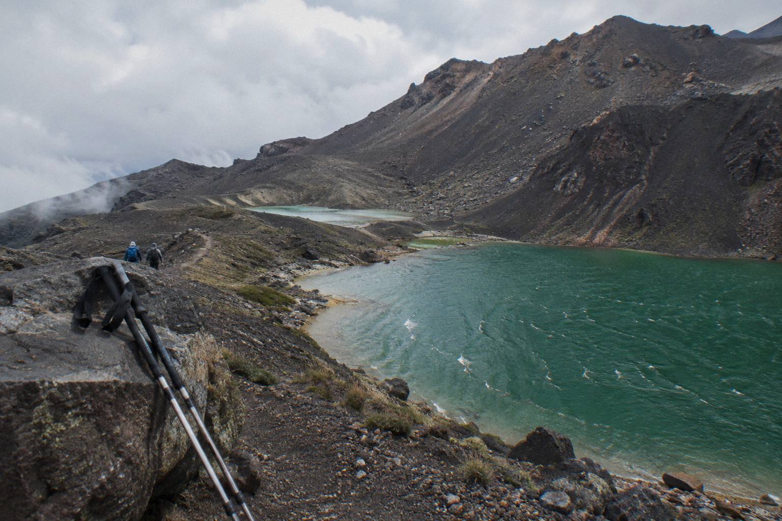
No, you should not swim in the Emerald Lakes on the Tongariro Crossing. Visitors are asked not to swim in, touch or enter the Emerald Lakes, and this applies to wading and paddle dipping as much as to swimming. The Department of Conservation publishes a request from Kaumatua Te Ngaehe Wanikau of Ngati Hikairo ki Tongariro asking people to respect the maunga tapu, the sacred mountains, by not touching or entering the waterways, including the alpine lakes.
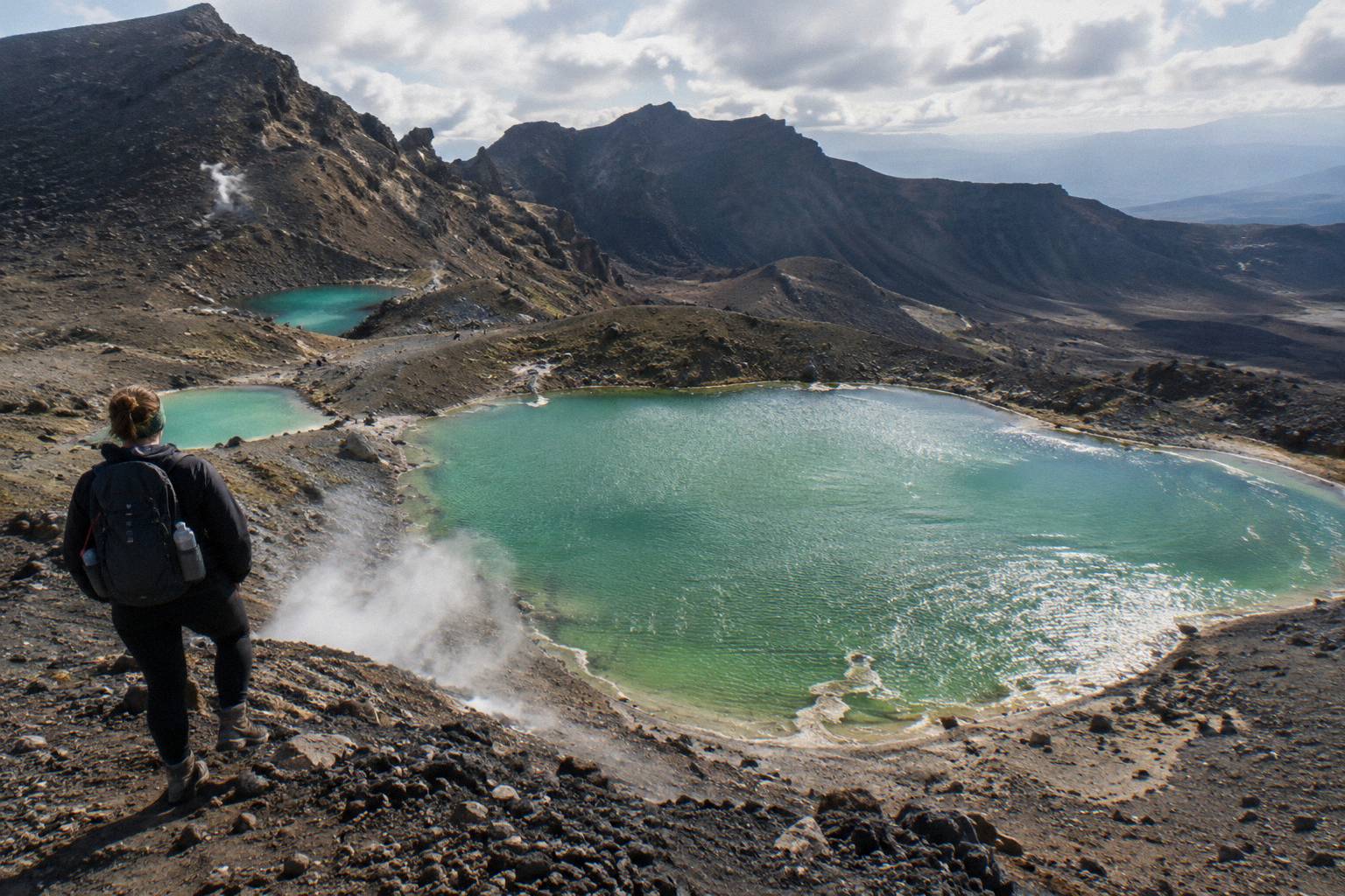
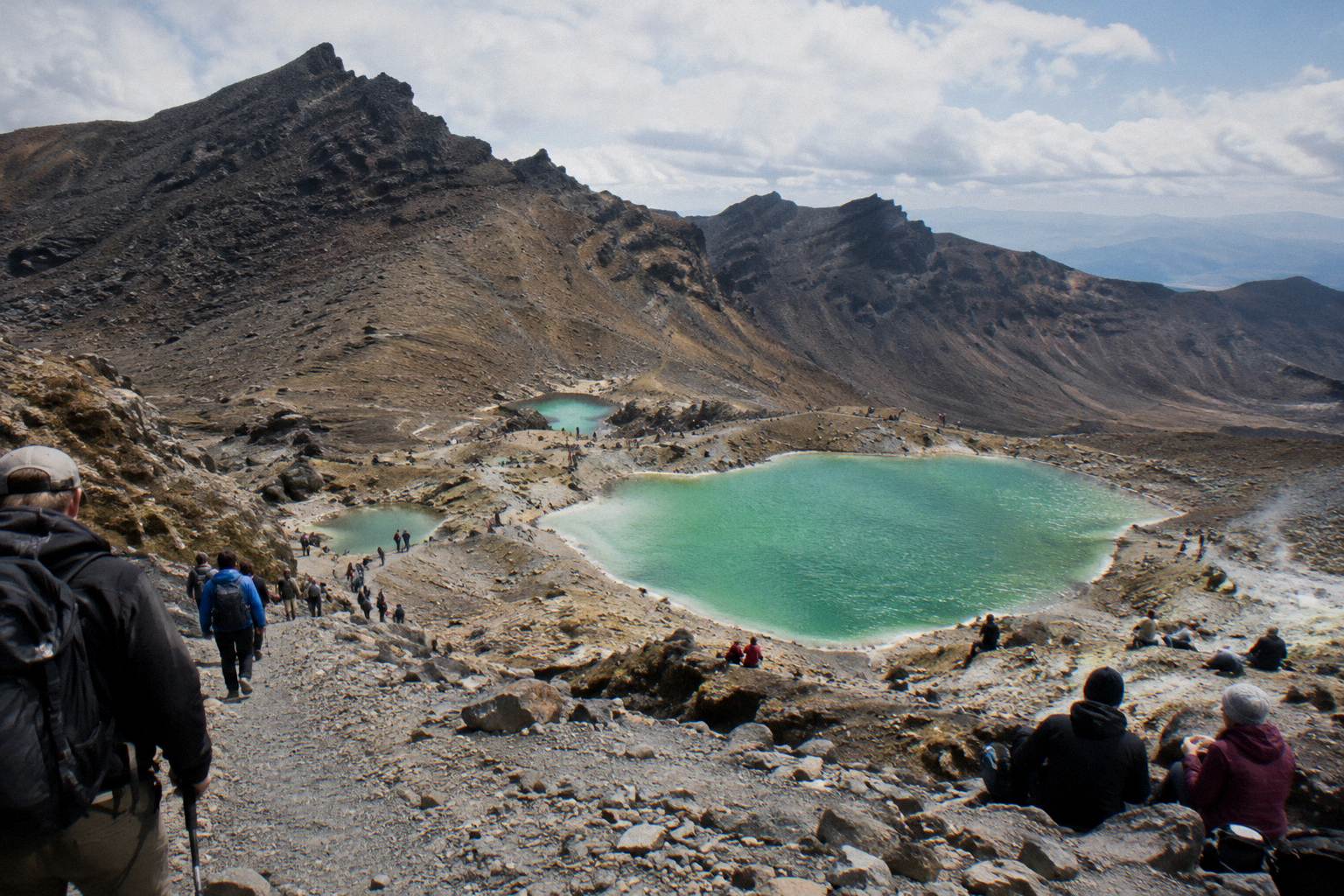
That request is the whole answer, but it deserves context, because the lakes look exactly like the kind of water you would want to plunge into. Three vivid green pools sit in a row below Red Crater, the high point of the Tongariro Alpine Crossing at 1886 metres, ringed by loose red and black scoria. On a still summer day the colour is almost artificial, a mineral green that photographs better than almost any other water in New Zealand. People naturally assume a swim is part of the deal. It is not, and the mountain communities ask that you treat the lakes as something to look at rather than to use.
The framing matters. This is not a swimming ban enforced by rangers at the shoreline, and you will not find a fence around the water. It is a cultural request from iwi, published by DOC on the official Tongariro Alpine Crossing page, grounded in the fact that Tongariro and its peaks are sacred to Ngati Hikairo ki Tongariro of Ngati Tuwharetoa. The park is a dual World Heritage area, recognised for both its volcanic landscape and its living Maori cultural values. Respecting the waterways is one of the visible, practical parts of that recognition.
There are practical reasons stacked on top of the cultural one. The lakes are volcanic crater lakes fed by heated mineral water, sitting at altitude on an exposed plateau where the weather can turn without much warning. Getting wet at nearly 1,900 metres, with wind and no shelter, is a genuinely bad idea even before the cultural dimension. If you want the full story of where the colour comes from, the companion guide to why the Emerald Lakes are green covers the mineral chemistry in detail.
For planning purposes, here are the verified numbers for the walk that brings you to the shoreline.
| Fact | Figure | Source note |
|---|---|---|
| Track length | 20.2 km one way | DOC |
| Elevation change | +/- 1,196 m | DOC |
| Highest point | Red Crater, 1,886 m | DOC |
| Summer walking time | 7 to 8 hours, November to April | DOC |
| Winter walking time | 9 hours, May to October | DOC |
| Fitness grading | High | DOC |
| Swimming in the lakes | Asked not to, per DOC wording | DOC |
How you reach the lakes is a booking decision, and there are two broad routes. Adrift Tongariro runs three guided tours, including the Adrift Tongariro premium guided hike from National Park Village, from NZ$450 per person, rated 4.6 across 242 reviews, with free cancellation up to 14 days before. The alternative is a shuttle and a self-guided walk, such as the Tongariro Crossing Shuttles round-trip from National Park Village, from NZ$75 per person and rated 4.7 across 890 reviews. Both get you to the same shoreline; only one puts a guide beside you when the cultural questions come up.
Whichever you choose, plan for a full day out. The booked duration on the Adrift premium guided hike is 8 to 9 hours door to door, and the shuttle day runs similar lengths, so the lakes are a mid-walk highlight rather than a quick stop.
Who Asks You Not To Enter, And Why?
The request comes from Kaumatua Te Ngaehe Wanikau of Ngati Hikairo ki Tongariro, and DOC publishes it in his words on the official track page. It asks visitors to respect the maunga tapu, the sacred mountains, by not touching or entering any of the waterways including the alpine lakes. The mountains of Tongariro are sacred to Ngati Hikairo ki Tongariro of Ngati Tuwharetoa, and the waterways are treated as part of the mountain itself rather than as recreation water.
Tongariro became New Zealand's first national park in 1894, gifted by Ngati Tuwharetoa chiefs including Horonuku Te Heuheu Tukino so the mountains would be protected rather than sold or broken up. That gift is the foundation of the park's dual World Heritage status, which recognises natural volcanic values and Maori cultural values together. For iwi, the peaks of Tongariro, including Ngauruhoe, the cone many visitors nickname Mount Doom for its Mordor look, are ancestors and taonga, not scenery. The request about the waterways flows directly from that relationship.
It helps to understand what the Emerald Lakes are in volcanic terms. They are explosion craters, known as Nga Rotopounamu, sitting on the shelf below Red Crater, filled with water coloured by minerals leached from the heated ground around them. DOC's own description of the descent from Red Crater calls them vivid, and the steep scorie slope above them is one of the most photographed moments of the whole 20.2 km track. Because they are part of an active volcanic system, the lakes are connected in a physical sense to the maunga as well as a cultural one. The 2012 Te Maari eruptions on the same massif are a reminder that this landscape is live, and volcanic alert levels on the mountain change daily.
The request is written respectfully and it deserves a respectful response. Nobody is going to chase you down the scoria. But this is a place where the hosting culture has made a specific, reasonable ask of visitors, and the walk is better when you understand it. If you book a guided day, this is exactly the kind of context a guide adds on the spot. The Adrift Tongariro premium guided hike, from NZ$450 per person, rated 4.6 across 242 reviews with free cancellation up to 14 days before, includes a guide for the full Crossing, and crampons and ice axes are supplied for winter conditions if required. Bring your own lunch; it is not included.
Is a guided day the right call for your trip?
Between the cultural framing and the practical safety picture, the question of swimming quietly answers itself for most people. The rest of this page covers what you can do at the lakes, how to time your day, and the mistakes that trip people up at this point on the track.
What Can You Actually Do At The Lakes?
You can stand at the shoreline, take photographs, rest, and eat while taking in the colour and the steam rising off the surrounding ground, and all of that is welcomed. What you cannot do is touch or enter the water itself, so no wading, collecting, or dipping hands or clothing in; most walkers spend fifteen to forty minutes at the bench between the lakes.
The lakes arrive with drama. You crest Red Crater at 1,886 metres, the highest point of the walk, and the track drops down a steep scree slope directly toward the green water. DOC describes it as a steep scorie descent to the vivid lakes, and the first full view of all three, with Blue Lake visible further along the ridge and the Central Crater spread between, is the moment most walkers remember. The Red Crater to Emerald Lakes descent guide covers that slope in detail, including how to place your feet on loose ground.
Photography is the main activity, and the light changes fast. The green reads strongest in midday to early afternoon sun, while a morning arrival can catch the lakes in shadow with steam drifting off the warm ground behind them. The photographing the Emerald Lakes guide goes deep on angles and timing. If you want that classic shot, it pays to build slack into your day rather than rushing the stop, which is one argument for an unhurried shuttle plan or a guided pace.
Here is what fits comfortably at the lakes, and what does not.
| At the lakes | Welcome? | Notes |
|---|---|---|
| Photographing from the shore | Yes | The standard viewpoint sits on the bench between the lakes |
| Resting and eating lunch | Yes | Pack out everything you bring |
| Walking the track past the water | Yes | The marked track passes the shoreline |
| Touching or entering the water | No | DOC-published request covers all waterways |
| Collecting water or stones | No | Same request, and removing rock damages the crater |
| Climbing into the craters around the lakes | No | Loose ground, thermal features, and cultural request |
One point worth repeating: the request covers all the waterways of the area, not just these three lakes. That includes the streams you cross earlier in the walk and Blue Lake further along the track. Blue Lake, called Te Wai-whakaata-o-te-Rangihiroa, carries particular cultural significance, and the Blue Lake on the Tongariro Crossing guide explains its story. The consistent rule is simple: enjoy the water with your eyes, leave it untouched.
Timing your stop well depends on how your day is structured. Independent walkers on a shuttle schedule often reach the lakes around the middle of their 7 to 8 hour summer day, and the how much time you need at the Emerald Lakes post breaks down realistic stop lengths. Guided groups typically pause here for a rest and interpretation, which is when the cultural and volcanic story gets told properly.
How Do You Get To The Lakes In The First Place?
You get to the Emerald Lakes by walking the Tongariro Alpine Crossing, a 20.2 km one-way track from Mangatepopo to Ketetahi Road, with the lakes sitting roughly two thirds of the way along, after Red Crater and before the Ketetahi descent. In practice, almost everyone arrives via shuttle or guided tour, since summer parking at the road ends is limited to 4 hours, and DOC suggests booking a shuttle from Labour weekend in late October to 30 April.
The logistics shape the whole day. Park at Mangatepopo in summer and you risk restrictions, and DOC states outright that there is no parking for Crossing walkers at the Mangatepopo car park in the summer season, with a private car park operating near Ketetahi. The standard solutions are a round-trip shuttle from a village base, or a one-way park-and-ride where you leave your car at the Ketetahi end, ride to Mangatepopo, and walk back to your own vehicle.
The Ruapehu Scenic Shuttles Ketetahi park-and-ride is the most reviewed option of that one-way style, rated 4.8 across 670 reviews, from NZ$68 per person, with free cancellation up to 24 hours before. It is a shuttle only, one way, and not guided; you walk the Crossing on your own legs and your own judgement. The booked day duration is 8 hours. The operator departs from the Ketetahi car park at Otukou.
Coming from the south, the Tongariro Expeditions Crossing shuttle from Taupo or Turangi covers the long-distance version, from NZ$75 per person and rated 4.7 across 431 reviews, with free cancellation up to 24 hours before. Taupo is 86.5 km from the track and Turangi 36.7 km by DOC's own distance figures, so a through shuttle saves a very early self-drive start. Departure points depend on the option booked: Taupo, Turangi or the Ketetahi Park & Ride. Again, it is a shuttle, not a guided walk.
Guided days bundle the transport question into one booking. Adrift Tongariro runs the three guided tours from its base at 53 Carroll Street in National Park Village, and the private version, the Adrift Tongariro private guided Crossing, rated 4.5 across 30 reviews, offers a sole-guide day for those who want the mountain explained at their own pace. National Park Village is 13.5 km from the track by DOC's figures, one of the closest bases. For a wider comparison of the guide decision, read whether a guide is worth it for the Emerald Lakes section.
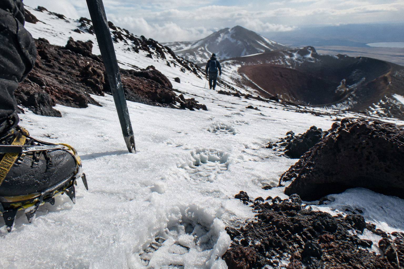
One thing to plan around: shuttle buses generally do not operate through winter, May to late October, while guided trips include transport and run with winter gear, crampons and ice axes supplied if required. In winter DOC grades the route Expert and says alpine skills are essential, best with a guide. If your swim question arises on a winter trip, the guided answer is effectively the only supported one.
What Trips People Up At The Emerald Lakes?
Most people stumble in the same ways: they treat the request as optional, expect the lakes to be a swimming stop, underestimate a 20.2 km walk with 1,196 m of elevation change and a High fitness grading, and arrive with no plan for the parking restrictions. Add the steep, loose scree on the descent from Red Crater, where there is no formed path, and the day punishes casual planning harder than the water question ever could.
The swimming assumption is worth defusing early, ideally before you pack a towel. Some walkers arrive having seen the lakes only in photos, where the green water reads like a tropical invite. The reality is a mineral-rich crater lake at altitude on a sacred mountain, and the shoreline is a rest stop, not a beach. If travelling with teenagers or a keen swimmer, set the expectation in the car park rather than at the water's edge.
The second trip-up is timing. Plenty of itineraries treat the Crossing as a half-day stroll. It is not: DOC's time band is 7 to 8 hours in the November to April season and 9 hours in the May to October window, and that assumes steady movement. The fitness for the climb to the Emerald Lakes guide gives an honest picture of the training question, and the sunrise start on the Crossing guide explains why an early start matters for both the weather window and the crowds.
Third, transport assumptions. The four hour parking maximum at the road ends from Labour weekend to 30 April exists precisely because the walk takes far longer than four hours. Book the shuttle before you drive, and make the DOC booking system entry, which is free and recommended, part of the same sitting. The shuttle timetable for the Emerald Lakes day guide lays out how the day sequences.
Fourth, the water itself in a different sense: hydration. There is no reliable drinking water on the high section, and a hot summer day over the exposed crater country takes more fluid than people expect. Carry what you need for the full walk. And check conditions before you commit: the Tongariro Crossing weather above the Emerald Lakes guide explains how the morning advisory works, and DOC's volcanic risk page for the park is the official word on hazards at volcanic risk in Tongariro National Park. Operators are bound by DOC rules not to run on hazardous-weather-warning days, and shuttles and guides run conditions allowing.
Fifth, respect in the small things. Litter, drone noise and shortcutting the track all damage the same values the waterway request protects. The swimming in the Emerald Lakes guide goes further into the tikanga for readers who want the deeper background. The short version: come, look hard, take pictures, and leave the water exactly as you found it.
A note on the surrounding walks: if conditions on the Crossing are poor, DOC points to Taranaki Falls and Tama Lakes as alternative walks in the park, and the other hikes near the Crossing start guide covers them. The waterway request applies across the park's alpine water, so the same no-swimming etiquette travels with you.
Whichever of those three you lean toward, the honest summary of this whole question is unglamorous: the best way to experience the Emerald Lakes is dry, well-timed and well-informed. This site, Tongariro Emerald Lakes Hike, exists to make that kind of day easy to plan, from the walk time to the Emerald Lakes through to the finish at Ketetahi after the Emerald Lakes.
Common Questions About Swimming In The Emerald Lakes
Can You Swim In The Emerald Lakes On The Tongariro Crossing?
No. DOC publishes a request from Kaumatua Te Ngaehe Wanikau asking visitors to respect the sacred mountains by not touching or entering any of the waterways including the alpine lakes. It applies to swimming, wading and touching the water, and it is a cultural request rather than an enforced ban.
Is It Illegal To Swim In The Emerald Lakes?
DOC presents it as a request from iwi rather than a rule with penalties, so there is no fine published on the track page. The mountains are sacred to Ngati Hikairo ki Tongariro of Ngati Tuwharetoa, and visitors are asked to honour that by staying out of all waterways on the walk.
Why Are The Emerald Lakes So Green?
Minerals leached from the heated volcanic ground around the craters colour the water. The lakes are explosion craters below Red Crater, the high point of the Crossing at 1,886 metres, and DOC describes them as vivid in its own track notes.
Can You Touch The Water In The Emerald Lakes?
No, the request covers touching or entering the water, not only swimming. Collecting water or stones is also best avoided; the craters are part of a sacred and thermally active landscape.
Where Can You Swim Near The Tongariro Crossing?
The waterway request applies across the park's alpine water, so treat streams and alpine lakes along the track the same way. For swimming generally, look outside the sacred mountain area rather than treating any Crossing waterway as an option.
Do You Need A Guide To Reach The Emerald Lakes?
No, but a guide changes the day. Adrift Tongariro runs the three guided tours of the Crossing, from NZ$450 per person on the premium guided hike, rated 4.6 across 242 reviews, while shuttle options from NZ$68 per person let you walk self-guided. In winter, May to October, DOC grades the route Expert and recommends going with a guide.